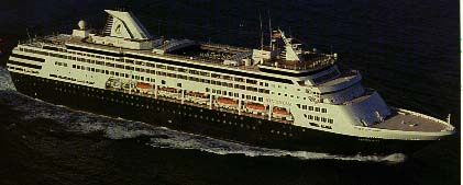
| ms Statendam |
 |
ms Statendam Specifications (TBR)
|
|
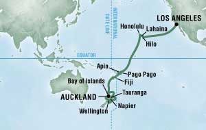
I've got 7 work days until my retirement on July 31, 2007. Sandy retires the same day. This calls for a celebration so Sandy booked a cruise from Los Angeles to New Zealand on the Holland America MS Statendam. We sailed on the Statendam before in 1998 when we traveled back from Alaska. This cruise is a "repositioning" cruise. Each year, the ship has to move from its "summer" route in Alaska to its "winter" route between New Zealand and Australia. Sandy booked it at Vacations To Go. These repositioning cruises tend to run less than many cruises so we were able to book it quite a while ahead and still get it for $80/day/head. This type of cruise isn't a commodity so that they do tend to book up early. This cruise was fully booked 3 months ahead of it's sailing date.
After we reach New Zealand, we're going to ride the rails for a couple of weeks and then fly back to Los Angeles. This part of the trip isn't booked yet and is subject to change.
It is still a couple of months to go before we leave. this is pretty much what I could find about the ship and our itinerary. I have lots of photos of the ship from the last time, but I'm going to take and post new photos after we get on the ship. In the last 9 years, it has probably gone through some refitting.
|
ms Statendam Specifications (TBR)
|
 |
|
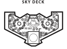
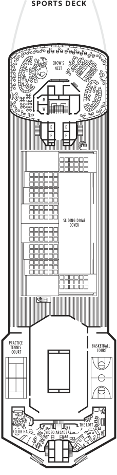
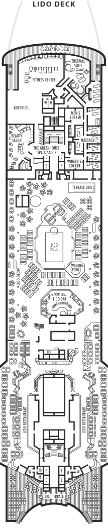
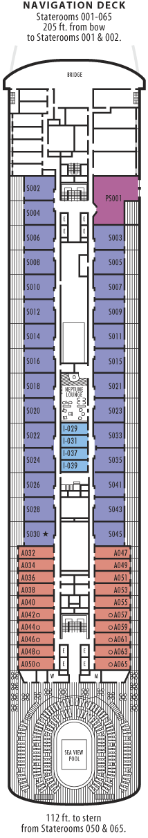
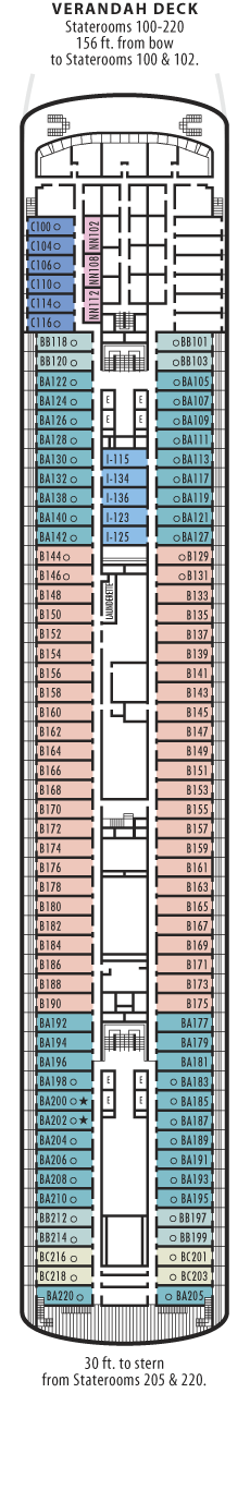
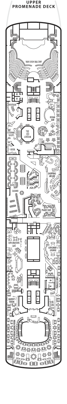
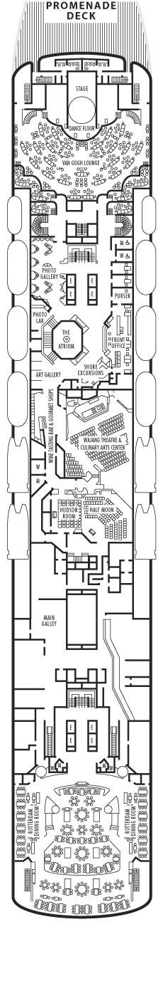
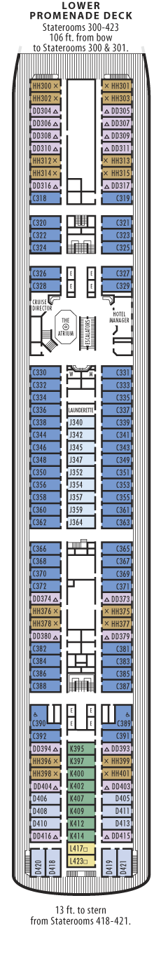
| Sky Deck | Sports Deck | Lido Deck | Navigation Deck | Verandah Deck | ||||||||||
|
|
|
|
|
||||||||||
| Upper Promenade Deck | Promenade Deck | Lower Promenade Deck | Main Deck | A Deck | ||||||||||
|
|
|
|
|
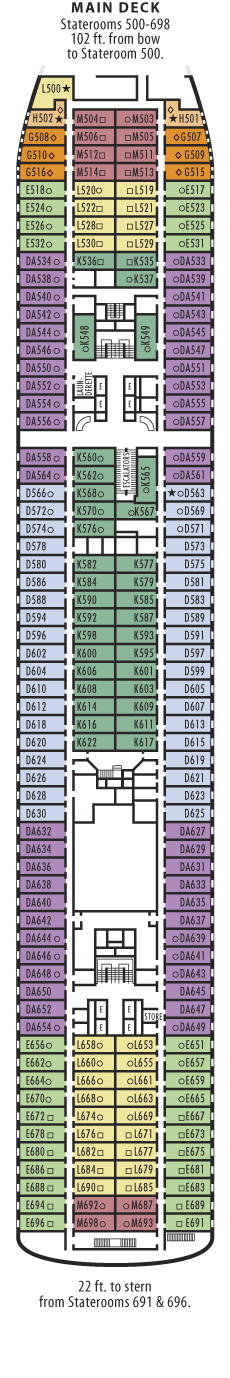
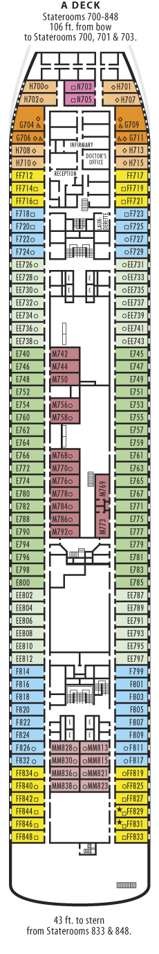
Our travel documents have arrived and we have done the on-line check in. Our stateroom is K598, an inside cabin about amidships on the Main Deck. The ship actually departs from Long Beach.
Sandy is working on extensions to the trip in New Zealand, probably a combination of rail and coach transportation through the North and South islands for a couple of weeks. She is also planning on adding a week in Hawai'i, probably Kaua'i, where her father will meet us. He's never been to Hawai'i.
The "large inside stateroom" is described at the link. There is a link there to a virtual tour. Click "back" on your browser to get back here.
It's the day before the cruise starts and I've actually started to pack. I've been making lists and piles, but not actually packing until today. The New Zealand part of the trip has actually finalized, Brenden Tours FINALLY confirmed our reservation just yesterday. Sandy was getting ready for plan B.
Sandy has been at work on her web page too. She has updated her travel log page with more details of the plan and an entirely different set of photos.
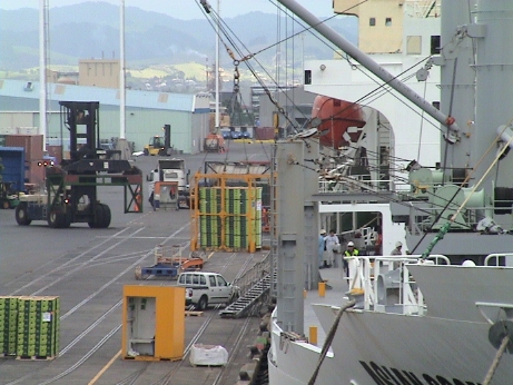
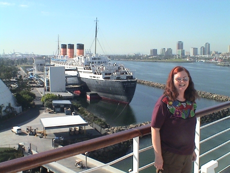 We've made it on board, had lunch, unpacked,
and explored a bit. Long Beach has built a cruise terminal into the old
Spruce Goose dome next to the Queen Mary. It'll hold one large cruise
ship at a time.
We've made it on board, had lunch, unpacked,
and explored a bit. Long Beach has built a cruise terminal into the old
Spruce Goose dome next to the Queen Mary. It'll hold one large cruise
ship at a time.
The ship is pretty much as I remember it, except the Explorer Lounge is now the Internet center as well as a library. The Internet works, at $0.40/min. The wireless coverage even works in the room. We get 3 bars. There is also a cellphone repeater (via a satellite link) that will work with most GSM phones. However, there will be a roaming charge of $2.50/min. Not too bad considering that the regular satellite telephone service is $7.95/min.
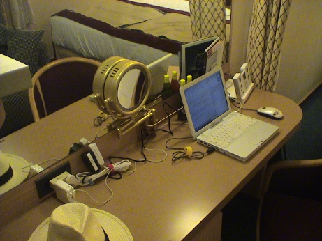 Our cabin is
pretty much the same as the one in the Ryndam, Oosterdam and Rotterdam.
Again, there is only one outlet on the desk, but we've come prepared
with an extension cord and a 3 way extender. AC power won't be a
problem this time.
Our cabin is
pretty much the same as the one in the Ryndam, Oosterdam and Rotterdam.
Again, there is only one outlet on the desk, but we've come prepared
with an extension cord and a 3 way extender. AC power won't be a
problem this time.
I'm kind of bummed out because I cannot locate my PDA. I had it earlier in the day, but I can't find it now. I probably left it somewhere. I left a report at the front desk, but it hadn't turned up them. Maybe it'll reappear later.
The lifeboat drill is at 1615 then we sail at 1700.
We set sail about a half hour late. The pilot steered us straight out of the breakwater and hopped off the boat. Then the captain put the pedal to the metal and we are off toward Hilo Hawai'i at about 21 mph. There won't be much to see off the boat for 5 days.
We have the late dinner sitting in the main dining room again and the waiting list is very long, so we don't have a chance of getting the early sitting. We will probably be eating many of our dinners in the Lido which is open all evening.
I woke up in the middle of the night and remembered what happened to my PDA. When we were at the security X-ray scanner, I had it in my shirt pocket. Just before I walked through the metal detector, I stuffed into the end pocket of my carry on bag, along with my stash of munchies. This is the ONLY part of my luggage that I didn't actually look in. It was there. It figures, you always find something in the last place that you look....
Yesterday, I found somebody's 256 MB Sony Memory Stick on the Sports Deck. The thing would have fit my camera and PDA, but it probably had vacation pictures on it and it wasn't mine so I turned it in to lost and found. If nobody claims it by the end of the cruise, maybe I'll try to claim it.
The ship was gently rolling all night long and along with the ever present low rumble of machinery and air handling equipment, and the creaks and groans as the ship flexes ever so slightly, it was actually easy to sleep.
After breakfast we took a 1-1/4 mile walk around the Lower Promenade Deck. The weather is cool and gray, but the temperature was just right for walking. Rain is in the forecast for later today.
Sandy went off the the Library to write, I checked out a copy of Stephen Hawking's "A Brief History of Time" to read. I've also finished a DIY video tour of the ship. I think that I did this ship once before so that maybe I'll compare the old video to the new video to see what is changed. I don't think that there are quite as many art objects on display as there were 9 years ago.
When I got back to the room, I found Sandy zonked out. She slept until lunch. Our routine for eating has settled out a bit. I am no longer trying to eat everything on the ship as I am trying to control my weight. We do penance for our food. We walk up 6 flights of stairs, eat, walk down 5 flights and then spend 20 minutes walking a mile on the Lower Promenade Deck (4 laps is a mile) and then down one more flight of stairs to our room. Doing this at least a couple of times a day will help with the battle of the bulge.
The flick today was Pirates of the Caribbean 3, long but entertaining. This took most of the late afternoon. Tonight is a formal dinner, but 2030 is still very late for dinner for us. A little fruit in the afternoon can forestall hunger while waiting for dinner time.
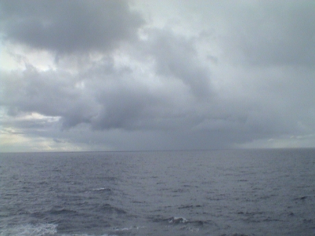 We crossed into
a new time zone overnight, we are now on Alaska time. After breakfast
this morning, we extended our walk a little to 1-3/4 miles. All the
while we were ducking in and out of little rain squalls like this one
off the port side.
We crossed into
a new time zone overnight, we are now on Alaska time. After breakfast
this morning, we extended our walk a little to 1-3/4 miles. All the
while we were ducking in and out of little rain squalls like this one
off the port side.
Last night was the first formal dinner. We both got so hungry an hour before dinner that we decided to skip it and eat at the Lido, but when we got there, we found that it had closed 15 minutes earlier. So it was back to the room to dress up and wait for the formal dinner, which was quite good. Eating dinner starting at 2030 and getting out close to 2200 isn't working out. I don't like to go to bed on a full stomach and we aren't staying up late enough for the shows which get out around midnight. There is no chance at all of getting into the earlier sitting so I think that we will be skipping the formal dining room fairly often.
After doing an informal survey of the ages of the passengers on this ship, I still think we are in the youngest 5%, maybe the youngest 2%. There exactly four children on this boat, all very little. Three of them belong to one family, the fourth belongs to a crew member. I guess that this makes sense as this is late September, all school age kids will be in school instead of cruising the high seas.
The Pacific Ocean has lived up to it's name.... so far. There has been very little swell and not a lot of wind. This has resulted in very little roll and virtually no pitch. The ride has been stable and smooth. The captain thinks that this isn't going to change much all the way to Hawai'i. After that, all bets are off.
Sandy and I spent part of the afternoon in the hot tub. I realize that its a rough life, but somebody's got to do it.
This evening, we decided to skip the main dining room and eat at a reasonable time at the Lido. We checked out the dining room menu on the way up to the Lido and, for the most part, they were serving the same stuff. The Lido was quiet, only about a quarter of the tables were occupied. Then it was downstairs 5 decks for another mile around the Lower Promenade deck. We have pretty much forsaken the elevators and are using the stairs just for the exercise. It's 6 flights up at least 3 times a day just for meals.
We spent one day on Alaska time, now its an unnamed time zone for a day at sea before reaching Hilo. The weather had been cool and comfortable since we left Long Beach and getting perceptibly warmer as we moved south. However, this morning it got a lot warmer, perhaps 80°F. The sea is still smooth and calm and there is little wind. There is little roll and no detectable pitch. We haven't really needed sea legs yet, but we'll see how if feels when we get back on land. We may notice it then.
After breakfast this morning we sat in on a tour talk for Pago Pago in American Samoa, Apia in Western Samoa and Suva in Fiji. We've already booked a tour for Pago Pago and it doesn't look like we are going to book any more for those islands. But first, we have three stops in Hawai'i, Hilo on the Big Island, Lahaina on Maui and Honolulu on Oahu. We've booked a trip to Mauna Kea, the highest mountain in Hawai'i. This is the location of many very large telescopes and the tour includes one of the Keck 10 meter reflector telescopes. We tried to get there the last time were on the Big Island, but as close as we got was the Keck visitor's center in Wiamea.
We took our customary one mile walk after the tour talk and then Sandy and I split to different activities for the balance of the morning. She wanted to rest for an hour before a knitting group met in the Exploration Lounge. I went on an iPod guided art tour. The ship loans out iPod Nanos with about a half hour of commentary on them. After the art tour, I went out to the starboard (shady) side of the Lower Promenade Deck to occupy a deck chair to write some of this commentary and to read my book. This book, "A Brief History of Time" is an overview of the physics of time and space. I've just finished the discussion of black holes and am moving on to the fate of the universe.
The Internet service on the ms Statendam has been pretty reliable, but when I started my art tour, the folks trying to use the terminals upstairs were complaining that it was "slow." Actually, it was more technically correctly "down" and remained that way for awhile. We are a little more than halfway to Hawai'i and we are probably in an area where there is little satellite coverage.
The Internet came back on after about 3 hours so I uploaded the page as it was.
We elected to eat early again and the show didn't look to inviting so we went back to the cabin. Then I noticed that the laundry down the hall was empty. Everyone was either at dinner or at the show. Sandy was out of clean clothes so we elected to do the laundry. I figure that we'll do laundry 7 to 10 times during the trip as we didn't bring all that much clothing. We're trying to pack lighter each time we go someplace. 5 to 7 days worth of clothes seems about right.
I finished "A Brief History of Time" and checked out a book about generals Patton and Rommel. We'll see how that one goes.
We noticed a small but perceptible increase in roll this morning. The sea has become a little choppy with low swells with some whitecaps. It is warm outside and very still. There must be a sea breeze coming off the stern at about our forward speed. During our walk after breakfast, I saw quite a few flying fish. These guys were pretty small and white in color. The looked like bugs flying less than a foot off the sea surface. They were apparently escaping the commotion of the ship's wake as they were usually moving directly away from the ship starting from just outside the wake. Some of them may have flown as much as 10 or 20 yards before diving back into the sea.
The Internet was down again, intermittent connectivity is pretty normal for shipboard satellite connections.
For the last two nights, we've eaten in the Lido at about 1800 instead of the main dining room at 2030. This is working out much better and the food is essentially the same, except the ambience is better in the dining room.
Tomorrow we go on our first shore excursion when we dock in Hilo. We are taking a 6 hour trip to Mauna Kea, an extinct volcanic peak. Mauna Kea is the location of several very large telescopes as the "seeing" is very good at 13,500 feet elevation and the weather is usually below the level of the telescopes. Our tour is supposed to include one of the Keck telescopes and it will take essentially all day.
During our walk this morning after breakfast, we caught our first sight of land in 5 days. The clouds were heavy and the form of Hawai'i was quite indistinct, but it was there.
By the time that we docked in Hilo, it was raining... hard. We had a long walk to the busses and even with raincoats and umbrellas, we got quite wet.
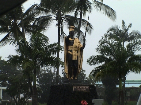 Our tour first wound through Hilo, but it
was raining so hard that it was impossible to take pictures from the
van. However, I was in the back seat and couldn't get out because many
of the others didn't want to to out in the rain. The driver opened the
back door and I was able to frame a good picture of the statue of King
Kamehameha I. This was the guy that eventually "united" all the major
islands into one kingdom.
Our tour first wound through Hilo, but it
was raining so hard that it was impossible to take pictures from the
van. However, I was in the back seat and couldn't get out because many
of the others didn't want to to out in the rain. The driver opened the
back door and I was able to frame a good picture of the statue of King
Kamehameha I. This was the guy that eventually "united" all the major
islands into one kingdom.
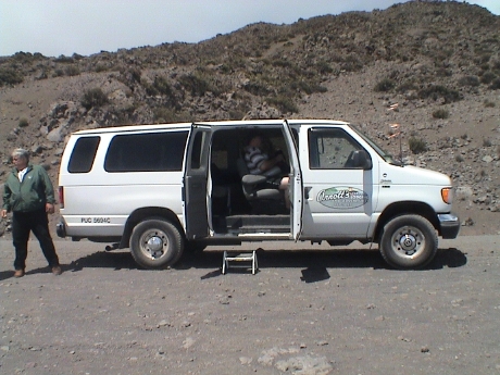 The van
itself is a "15 passenger" Ford van conversion. There were 14 people in
the van, two of them quite overweight so that they consumed one 3
person seat. I was in the 4 person back seat and it was a struggle to
get in and out. Sandy snagged a seat by the door. The van itself was 4
wheel drive and diesel powered. The diesel was equipped with a Jacobs
Engine Brake which was needed to get back down the very steep road to
the summit.
The van
itself is a "15 passenger" Ford van conversion. There were 14 people in
the van, two of them quite overweight so that they consumed one 3
person seat. I was in the 4 person back seat and it was a struggle to
get in and out. Sandy snagged a seat by the door. The van itself was 4
wheel drive and diesel powered. The diesel was equipped with a Jacobs
Engine Brake which was needed to get back down the very steep road to
the summit.
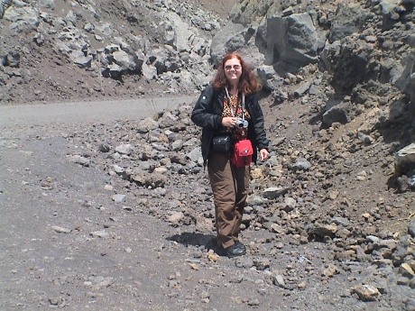 We made several "acclamation" stops on
the way up. This is Sandy at one of those stops. The driver asked
everybody to get out and walk around so that he could see if anybody
was having troubles with the altitude. He watched carefully as
everybody walked around. If a passenger began having difficulties, the
tour would end there. Fortunately, no one had a problem. We broke
through the cloud deck at about 11,000 feet.
We made several "acclamation" stops on
the way up. This is Sandy at one of those stops. The driver asked
everybody to get out and walk around so that he could see if anybody
was having troubles with the altitude. He watched carefully as
everybody walked around. If a passenger began having difficulties, the
tour would end there. Fortunately, no one had a problem. We broke
through the cloud deck at about 11,000 feet.
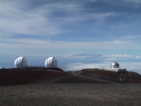 There are many telescopes on Mauna Kea, the two
white ones are the Keck 10 meter telescopes. The silver one is a NASA
infrared telescope used to detect possibly earth intercepting objects.
Others are the CalTech Submillimeter Telescope (CSO), the James Clerk
Maxwell Telescope (JCMT), the Smithsonian Submillimeter Array, the
Subaru optical telescope, the Canada-France-Hawai'i Telescope (CFHT),
the Gemini North Telescope, the UH 2.2 meter Telescope, the United
Kingdom Infrared Telescope (UKIRT) and the original UH 0.6 meter
telescope. Haleakala, a 10,000 foot peak on Maui can be seen in the
distance between and slightly above the telescope domes. We could also
see the Mauna Loa volcano peak to the south, but not anything else
except for the cloud deck.
There are many telescopes on Mauna Kea, the two
white ones are the Keck 10 meter telescopes. The silver one is a NASA
infrared telescope used to detect possibly earth intercepting objects.
Others are the CalTech Submillimeter Telescope (CSO), the James Clerk
Maxwell Telescope (JCMT), the Smithsonian Submillimeter Array, the
Subaru optical telescope, the Canada-France-Hawai'i Telescope (CFHT),
the Gemini North Telescope, the UH 2.2 meter Telescope, the United
Kingdom Infrared Telescope (UKIRT) and the original UH 0.6 meter
telescope. Haleakala, a 10,000 foot peak on Maui can be seen in the
distance between and slightly above the telescope domes. We could also
see the Mauna Loa volcano peak to the south, but not anything else
except for the cloud deck.
The weather on the mountain was quite good, it could have been much worse. The still air temperature was about 40°F. When protected from the wind and standing in the sun, it was very nice. However, with the wind blowing, it was quite cold and there was an intermittent very strong wind, maybe 30 mph or so. The wind wasn't enough to blow you off your feet, but it was enough to cut through my light jacket and ripple my pant legs.
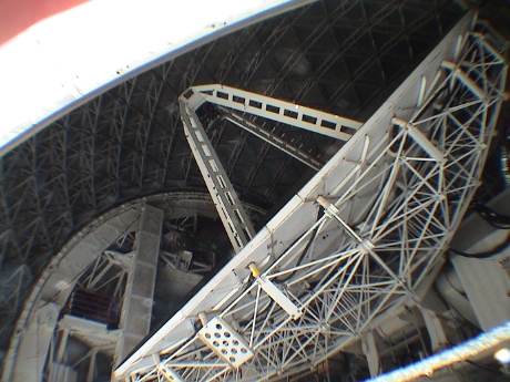
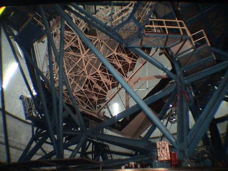 We were able to view the inside of Keck I
from a viewing area. The telescope is pointed mostly away from the
viewing area so the view is from the back of the mirror assembly. The
Keck twin telescopes are both 10 meter primary reflectors with
segmented main mirrors and adaptive optics. Both systems have proven to
work quite well. The two Kecks can be operated independently or
together as an interferometer to gain much better angular
resolution.
We were able to view the inside of Keck I
from a viewing area. The telescope is pointed mostly away from the
viewing area so the view is from the back of the mirror assembly. The
Keck twin telescopes are both 10 meter primary reflectors with
segmented main mirrors and adaptive optics. Both systems have proven to
work quite well. The two Kecks can be operated independently or
together as an interferometer to gain much better angular
resolution.
 The dome of the Caltech Submillimeter Telescope
was partially open and we were allowed to walk right up to it and take
pictures. The gimballed main and subreflector assembly can be seen in
this photo.
The dome of the Caltech Submillimeter Telescope
was partially open and we were allowed to walk right up to it and take
pictures. The gimballed main and subreflector assembly can be seen in
this photo.
After about an hour and a half on the mountain, we left to go back to the visitor's center for a light lunch (at about 1430) and then we left to return to the ship. It was raining most of the way back but the rain let up to allow us to reenter the ship without getting soaked. Just about the time that the ship left port, it was raining hard again.
Sandy and I got a snack that was supposed to be dinner. I went to see a movie, "Harry Potter and the Order of the Phoenix", and Sandy snoozed. After the movie, it was our scheduled dinner time so we ate yet again and then went out to see if we could see Kilauea. The ship took a southerly course after leaving Hilo to run by Kilauea but all we could see is a dull orange glow reflecting off the cloud deck above the volcano.
Tomorrow is Lahaina, Maui. There we expect to just walk around town as the center of town is really small, and our ship's tenders will use a pier right in the middle of the waterfront.
 After a short
overnight run to Maui, the ship anchored off the shore of Lahaina Maui.
We've been to Maui before so we elected just to walk around the small
town. Since the ship didn't tie up to a pier, we had to tender into
port. This is always a time consuming procedure and this time was no
different. It took an hour and a half to get on shore from the time we
were ready to leave.
After a short
overnight run to Maui, the ship anchored off the shore of Lahaina Maui.
We've been to Maui before so we elected just to walk around the small
town. Since the ship didn't tie up to a pier, we had to tender into
port. This is always a time consuming procedure and this time was no
different. It took an hour and a half to get on shore from the time we
were ready to leave.
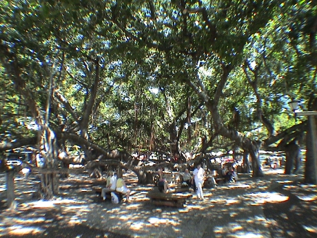
Right at the tender dock, there is a city park with a very large Banyan tree in it. This is just one tree with 16 trunks. The Banyan grows outward for awhile and then drops feelers. If they touch the ground, then they grow into new roots and eventually a new trunk to support the horizontal growth of the original tree. This tree covers much of the area of the park that it dominates.
This town has a disproportionate representation of jewelry shops, art galleries, clothing shops and gift shops along with a normal amount of bars, restaurants other retail businesses.
Our ultimate destination was actually Hilo Hatties, a popular retailer and gift shop about a quarter mile away. It was pretty hot and I was picking shady routes to get there and back. We got tired and returned to the ship mid-afternoon.
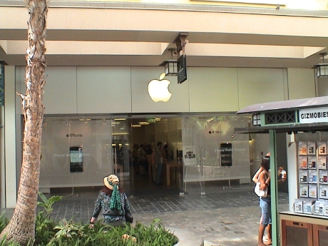 We didn't have any formal touring plans for
today as we've been to Honolulu several times before. It's just another
big city. However, it does have an Apple Store with free WiFi in the
Ala Moana mall. Sandy wanted to check out some particular Hawai'ian
clothing (didn't find it) and I wanted to catch up on web surfing at
low cost. We took TheBus, the Honolulu city bus system, to get there
and back. It worked pretty well, $4 round trip for the both of us, and
it went directly by the mall. We got back to the ship about 1130 to
contemplate our next move.
We didn't have any formal touring plans for
today as we've been to Honolulu several times before. It's just another
big city. However, it does have an Apple Store with free WiFi in the
Ala Moana mall. Sandy wanted to check out some particular Hawai'ian
clothing (didn't find it) and I wanted to catch up on web surfing at
low cost. We took TheBus, the Honolulu city bus system, to get there
and back. It worked pretty well, $4 round trip for the both of us, and
it went directly by the mall. We got back to the ship about 1130 to
contemplate our next move.
The weather in Honolulu is pretty normal, warm, humid and intermittent rain from a nearly clear blue sky. These cloudless rains are usually warm and not strong enough to get one actually wet, however it is still odd that it rains with no or virtually no clouds overhead.
Every day, we get an abridged copy of the New York Times delivered to the mail slot next to our door. However, there are other newspapers distributed as well. One common one is the Canadian. It's so common that it appears in about 1/3 of the stateroom mail slots. Based on listening to accents, I had figured that the passenger content was at least 25% Canadian, it might be more. This makes some sense as this cruise originated in Vancouver.
After lunch, we made another expedition out to restock Sandy's supply of diet cola. There appeared to be no place nearby that sold in bulk, so she was resigned to buy her stock at snack store prices, about $2/liter. However, when we got outside the WalMart shuttle was running so we went to WalMart where it was $1.25/2 liter bottle. She also bought a couple of shirts and I got a new pair of sandals as my old ones were dying rapidly. We took a small and empty roll around suitcase with us to pack the stuff back. It was full on the way back.
Sodas are available on the ship, but at significant extra cost. They sell a card good for 18 sodas for $20, but these are really small, probably about 6 oz total and that includes ice. That works out to more than $24/gal. She got her's for $5/gal. I've been doing fine on juice with breakfast and ice water the rest of the time.
After the WalMart trip, we decided to stay on the boat until it left, which happened promptly at 1900. The pilot pushed us off the pier with the thrusters, then backed us out into a turning basin, turned about 90° and sent us straight out to sea. We'll be at sea for five more days to reach Pago Pago (pronounced Pongo Pongo) in American Samoa. We'll be crossing into the southern hemisphere on day 12, the fourth day at sea on this leg. Our activities will be primarily eating, sleeping, walking (to work off some of the food), reading and all that tough stuff that you just have to do.
A stronger swell that we have yet experienced picked up last night and continued into the morning. The ship has picked up some pitch as well. It's not strong enough to seriously impede walking, but grabbing a handrail on the stairs is prudent. Several hours later, the sea turned pretty flat again.
We've shifted our eating schedule about 2 hours later in the day to accommodate our late seating in the dining room. This works for sea days because our room stays dark and we tend to sleep late too. The food in Lido is generally similar to that in the main dining room but the presentation in the dining room is better and there is more enforced portion control. Also the courses are presented in sequence so it takes an hour or more to eat. In the Lido, it's all there at once and I can rip through dinner in 10 minutes easy. Eating less and slower is better for controlling my weight. I can't eat as much as I used to without paying the price.
We've also fallen into the routine of walking the promenade deck for a mile either just before or just after most meals. I'm getting 2.5 to 3 miles a day in not including just moving about the ship, which is non-trivial in itself.
The ship's cruise staff runs a constant series of activities to help keep the passengers occupied. We get a schedule of the next day's planned activities every evening. These range through church services, Texas Hold'em, how to make a Bloody Mary, Bingo, Yoga classes, Blackjack, fitness classes, spa offers, cooking demonstrations and a variety of lectures. On the majority of this stuff, I take a pass, but I do go to some of lectures. Today's turned out to be an economics lecture on the development of the economies of south Pacific islands following WWII. There is also a feature film every day, I've seen Ratatouille, Harry Potter and the Order of the Phoenix, and Pirates of the Caribbean 3. That with eating, walking, reading, napping and writing this diary pretty much makes up my day.
We're still about 1500 nm from Pago Pago making about 18 knots. The weather today is gray skies with a "moderate" swell, however I would call it nearly flat. We signed up for another tour for New Zealand to go see a glow worm cave and limestone cavern. Most of our touring in New Zealand will be done in the 2nd phase of the trip where we have more time and we won't be paying ship's rates for tours (which are generally high). There was a new lecturer on board, Melvyn Foster, a Brit by accent. This guy is pretty good. His talk this morning was "Explorers, Castaways and Pirates" of the Pacific. He'll be doing more of them which we will probably attend. The economist, Cluny MacPherson, a Kiwi, will be talking again this afternoon too about some south Pacific political issues. The plan is also to go to a movie again, Shrek The Third. That will pretty much make a whole day.
Today, the sky is mostly clear and bright and the sea is calm. We're still in the northern Pacific, we cross the equator sometime tomorrow morning.
We went to a lecture this morning on Captain Cook's first journey. Mr. Foster, the lecturer has hit his stride, this was an excellent talk.
This is king crab and lobster night in the dining room so we'll be doing the late meal routine today.
We cross the equator about 0100 last night and set our clocks back one more hour to GMT - 11, Samoa Standard Time, The next time change is crossing the International Date Line. A day will appear to vanish.
I didn't upload a page update yesterday because the internet connection was virtually unusable all day. I expect more of the same today.
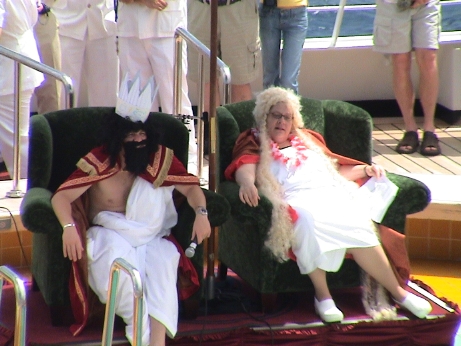 Since we crossed the equator last night, an
initiation ceremony is traditional for sailors that have never crossed
before. King Neptune presides over the initiation of "pollywogs" into
experienced sailors, or "shellbacks." Only the crew is involved, they
don't do this to passengers. First, the "accused" are presented to the
king and some trumped up charges are read.
Since we crossed the equator last night, an
initiation ceremony is traditional for sailors that have never crossed
before. King Neptune presides over the initiation of "pollywogs" into
experienced sailors, or "shellbacks." Only the crew is involved, they
don't do this to passengers. First, the "accused" are presented to the
king and some trumped up charges are read.
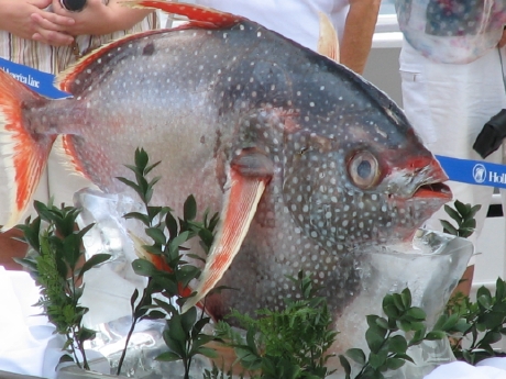 Then the
accused is found guilty and ordered to "kiss the fish." There is a
large frozen fish set up next to the thrones. Not all of the accused
acquiesced easily.
Then the
accused is found guilty and ordered to "kiss the fish." There is a
large frozen fish set up next to the thrones. Not all of the accused
acquiesced easily.
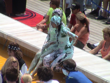 Then the convicted are lead to some tables
and they are slathered in goop that looks like colored whipped cream.
Then the ships senior staff either judges them to "survive" or be
dunked into the pool. Considering how goopy this stuff looks, I'd
rather be dunked. These two "survived" and had to sit in the hot sun
covered in goop. All the charges were read by the cruise director
dressed as an English judge. He was the last one to get it.
Then the convicted are lead to some tables
and they are slathered in goop that looks like colored whipped cream.
Then the ships senior staff either judges them to "survive" or be
dunked into the pool. Considering how goopy this stuff looks, I'd
rather be dunked. These two "survived" and had to sit in the hot sun
covered in goop. All the charges were read by the cruise director
dressed as an English judge. He was the last one to get it.
By the way, we got certificates with the proclamation that we have sailed through the equator by ship (airplanes don't count) signed by Captain Jack....von Coevorden. We are now officially, Shellbacks. It goes something like this.
CROSSING
|
Last night, I finished Patton and Rommel. This was, overall, a pretty good book, recently published in 2005. I've checked out another called, "The Submarine, A History" by Thomas Parrish. This is 500+ pages of fairly fine print, it should keep me occupied for the rest of the cruise.
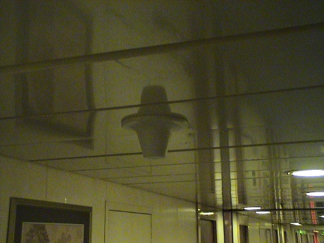 Yesterday, I was curious why the WiFi signal in our
stateroom was relatively good, especially considering that the room is
essentially a steel box. I did a little war-walking and it turns out
that this structure mounted in the hallway ceiling is a WiFi antenna
and it is almost directly outside our room. I don't know if it is also
used as the cell phone repeater as the cell phone coverage in the room
is highly variable, sometimes 4 bars, sometimes no signal at all.
Yesterday, I was curious why the WiFi signal in our
stateroom was relatively good, especially considering that the room is
essentially a steel box. I did a little war-walking and it turns out
that this structure mounted in the hallway ceiling is a WiFi antenna
and it is almost directly outside our room. I don't know if it is also
used as the cell phone repeater as the cell phone coverage in the room
is highly variable, sometimes 4 bars, sometimes no signal at all.
We actually had two, smaller, dinners again last night. Sandy was hungry so we went to the Lido early, she had prime rib and I had more seafood. Then at 2030, we went to the formal dining room and I had prime rib and she had a steak. Eating 4 meals a day can have profound impacts on the waistline so I attempted to atone for my sins, at least in part, by walking it off. Over the course of the day, I did 5.5 miles on the Lower Promenade Deck. I figure that that was good for a little more than 1000 calories. In any event, my belt is still a full notch tighter than when I was working and hasn't changed since the start of the cruise.
Today was another relaxing sea day. In the morning, Melvyn Foster gave a very interesting and entertaining talk about pirate women. Cluny Macpherson described some success stories in economic development in a couple of south Pacific islands. Now I know where all the black pearls come from, they are sold all over the south Pacific.
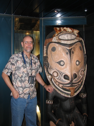 Just outside the main theatre at the Deck
7 Port entrance is this hand carved wooden Maori statue. It was common
for the Maori to have their tongues (and other things) hanging out.
Just outside the main theatre at the Deck
7 Port entrance is this hand carved wooden Maori statue. It was common
for the Maori to have their tongues (and other things) hanging out.
The satellite internet connection has been really flakey for the last couple of days, it's been hard to get anything done in cyberspace.
This late seating for dinner is really messing us up. The inconveniences on a cruise ship are just terrible. We've tried eating late, at 2030, at our main dining room seating time, but that's too late. Further, Sandy tends to leave hungry because she won't order the "weird" stuff to fill out her meal. We've tried shifting our lunch later, but that hasn't worked as the Lido closes up lunch early and I'm programmed for lunch about noon, no matter when I've eaten breakfast. We've eaten dinner early at the Lido, but then we miss out on the usually well presented and prepared dining room meal. We've tried eating TWO dinners, both lighter than normal but still, taken together, it's too much food. The plan now is an evening snack but we can't do it at the Lido because then it tends to become a full meal. So Sandy gets an extra sandwich at lunch to eat in the early evening and I'll just work on the fruit bowl in our room. We'll see how that goes.
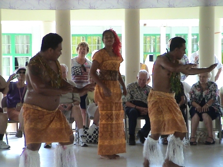 We arrived Pago Pago in American Samoa this
morning and took a tour out to a traditional Samoan dance and kava
ceremony. The ceremony itself was held in a "fala" or public house.
This is basically a large roof supported by columns around without
closed walls. This kind of structure is highly useful as it allows full
airflow from any direction. Since it is much more often warmer than
cooler here, this is a good thing.
We arrived Pago Pago in American Samoa this
morning and took a tour out to a traditional Samoan dance and kava
ceremony. The ceremony itself was held in a "fala" or public house.
This is basically a large roof supported by columns around without
closed walls. This kind of structure is highly useful as it allows full
airflow from any direction. Since it is much more often warmer than
cooler here, this is a good thing.
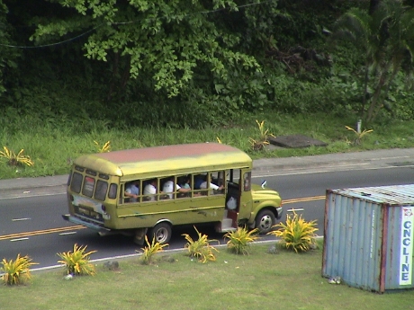 The
standard bus on American Samoa is a short truck chassis with a little
bus body built on it. It is similar to the one that we rode to the
Samoan village. It has no A/C other than open windows and the seats are
plywood, but they are practical. A typical bus ride costs $1.25.
The
standard bus on American Samoa is a short truck chassis with a little
bus body built on it. It is similar to the one that we rode to the
Samoan village. It has no A/C other than open windows and the seats are
plywood, but they are practical. A typical bus ride costs $1.25.
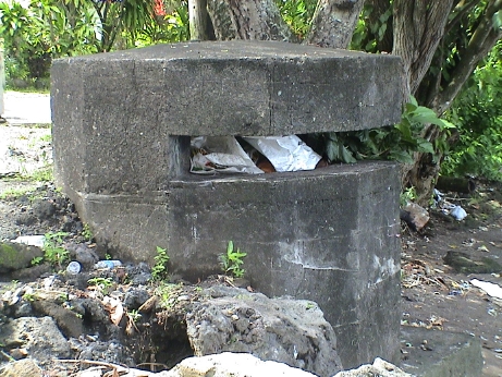 American Samoa
is a US territory. It was originally annexed as a coaling station for
the Navy as it has an excellent deep water harbor, but with the advent
of oil fired ships, the station really wasn't needed anymore and was
evacuated in 1952. However, during it's time as a navel base, there
were fortifications installed. I was told that there are 83 of these
pillboxes still on the island, this one is currently being used as a
trash dumpster. In 1889, the British, Germans and Americans negotiated
an agreement (without any participation by the Samoans) that ceded what
is now known as Western Samoa to the Germans, American Samoa to the
Americans and Tonga to the British. Western Samoa (where we go
tomorrow) achieved independence. American Samoa stayed as a US
territory. I don't know the current status of Tonga.
American Samoa
is a US territory. It was originally annexed as a coaling station for
the Navy as it has an excellent deep water harbor, but with the advent
of oil fired ships, the station really wasn't needed anymore and was
evacuated in 1952. However, during it's time as a navel base, there
were fortifications installed. I was told that there are 83 of these
pillboxes still on the island, this one is currently being used as a
trash dumpster. In 1889, the British, Germans and Americans negotiated
an agreement (without any participation by the Samoans) that ceded what
is now known as Western Samoa to the Germans, American Samoa to the
Americans and Tonga to the British. Western Samoa (where we go
tomorrow) achieved independence. American Samoa stayed as a US
territory. I don't know the current status of Tonga.
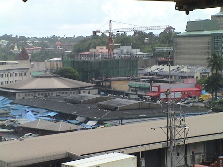
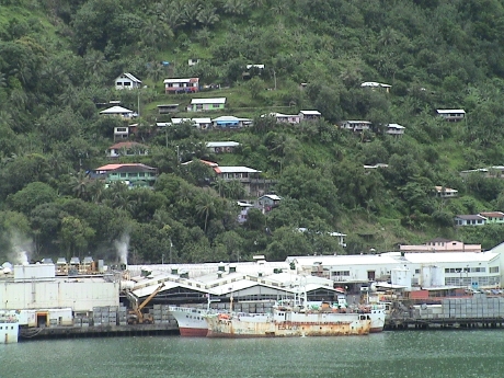 Across the harbor from the ship's berth at a
container terminal is "cannery row." This is a major employer on the
island, but they employ mostly Western Samoans living in American Samoa
for work. Most of the employed American Samoans work for the US
government in some way. Since the mountains go pretty much straight up
from the harbor, many of the houses are built as far up the hillside as
they care to go. Another part of the island has some fairly large
tracts of nearly level land, this is where most of the people live.
Across the harbor from the ship's berth at a
container terminal is "cannery row." This is a major employer on the
island, but they employ mostly Western Samoans living in American Samoa
for work. Most of the employed American Samoans work for the US
government in some way. Since the mountains go pretty much straight up
from the harbor, many of the houses are built as far up the hillside as
they care to go. Another part of the island has some fairly large
tracts of nearly level land, this is where most of the people live.
 Sandy and I went out in the afternoon to walk
around Fagatogo, the little town next to the container port. It had
rained a little while we were on the ship for lunch so we took our
raingear because it looked like it could rain again. It did, and very
hard at that. The temperature was quite warm and the humidity was very
high already, with the rain, the humidity probably went to the max. We
were at about the furthest part of our wandering and the sky let loose.
We walked back through the worst of it and then we found the Samoan
Heritage Museum that we were actually looking for. We had bypassed it
from behind on the way out. In the museum were many artifacts of Samoan
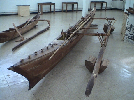
culture including this full size outrigger canoe.
Sandy and I went out in the afternoon to walk
around Fagatogo, the little town next to the container port. It had
rained a little while we were on the ship for lunch so we took our
raingear because it looked like it could rain again. It did, and very
hard at that. The temperature was quite warm and the humidity was very
high already, with the rain, the humidity probably went to the max. We
were at about the furthest part of our wandering and the sky let loose.
We walked back through the worst of it and then we found the Samoan
Heritage Museum that we were actually looking for. We had bypassed it
from behind on the way out. In the museum were many artifacts of Samoan
culture including this full size outrigger canoe.
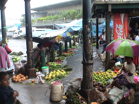
In our exploration of Fagatogo, we wandered through a couple of stores. Since the island is small, there are few stores and the ones that are there carry a wide variety of goods. One was mostly groceries and textiles, but there was also shoes, clothing, hardware, furniture, safes, cooking utensils, watches, jewelry, and all manner of other stuff. Except for the textiles (of which they had a lot), they had something of everything, but not a lot of anything.
There were a series of tent shelters set up just inside the port entrance with vendors selling all manner of Samoan handy craft. None of it appealed to me. One of the communications companies had set up a tent in the container terminal offering phone services and internet access. The internet site was actually set up in the port police office. It was slow, but still faster than the ship's access and much cheaper. I was able to catch on the outside world, not much had happened.
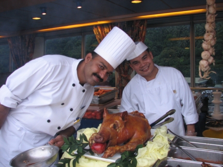 Dinner was
a barbecue set up on the Lido. It was pretty good especially due to the
addition to the roast suckling pig. The ship didn't sail until late,
most likely after I went to bed.
Dinner was
a barbecue set up on the Lido. It was pretty good especially due to the
addition to the roast suckling pig. The ship didn't sail until late,
most likely after I went to bed.
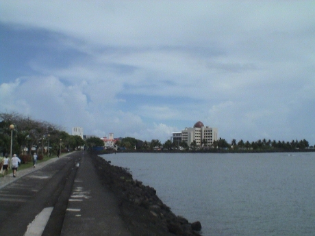 When
we arrived at Apia, the sky looked like it could rain any time. By the
time we finished breakfast, it was raining but it had quit again by the
time we got off the ship at the container port. After checking out the
flea market set up on the pier especially for us, we ran the taxi
driver gauntlet and walked into town around the bay. It was about 3.5
miles round trip to the city center where a bigger flea market was
supposed to be but we didn't find it. It was hot and humid walking
along the seawall, but fortunately, it clouded up again so that the sun
wasn't too intense. It didn't rain again.
When
we arrived at Apia, the sky looked like it could rain any time. By the
time we finished breakfast, it was raining but it had quit again by the
time we got off the ship at the container port. After checking out the
flea market set up on the pier especially for us, we ran the taxi
driver gauntlet and walked into town around the bay. It was about 3.5
miles round trip to the city center where a bigger flea market was
supposed to be but we didn't find it. It was hot and humid walking
along the seawall, but fortunately, it clouded up again so that the sun
wasn't too intense. It didn't rain again.
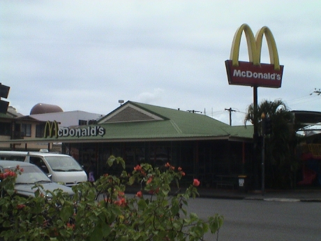 We did find a MacDonald's, these things are
everywhere. Some Samoans apparently consider this a high class
restaurant.
We did find a MacDonald's, these things are
everywhere. Some Samoans apparently consider this a high class
restaurant.
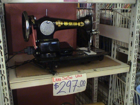 We stopped in a largish market and
found the same mix of general merchandise that we had found in American
Samoa, but with a larger selection. There was even a chinese knockoff
of a 1920's vintage Singer. The price is in tala. One
tala is about $0.36 US.
We stopped in a largish market and
found the same mix of general merchandise that we had found in American
Samoa, but with a larger selection. There was even a chinese knockoff
of a 1920's vintage Singer. The price is in tala. One
tala is about $0.36 US.
 About half way back, we found another Samoan
museum. This one has that tropical colonial look to it. Apia is a
pretty large city by Pacific island standards and has a rich mixture of
architecture. Western Samoa has the feel of a prosperous nation, much
more so than American Samoa.
About half way back, we found another Samoan
museum. This one has that tropical colonial look to it. Apia is a
pretty large city by Pacific island standards and has a rich mixture of
architecture. Western Samoa has the feel of a prosperous nation, much
more so than American Samoa.
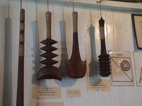 The museum one had a pretty good collection of
Samoan artifacts too, including these wooden war clubs. They may have
been made of wood, but I still wouldn't want to be bashed in the head
with one.
The museum one had a pretty good collection of
Samoan artifacts too, including these wooden war clubs. They may have
been made of wood, but I still wouldn't want to be bashed in the head
with one.
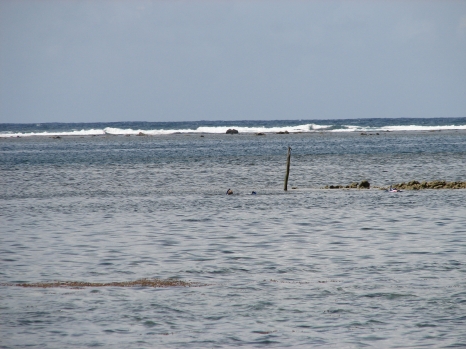 After lunch back on the ship, we walked a few
hundred yards from the entrance to the container terminal to a marine
reserve. The snorkeling was good. The water was clear and warm, there
were lots of fish and I got some underwater pictures. However, they are
on film and the camera leaked a little so the film may not come out.
The leak was probably caused by me using the camera as a club on one
fish to keep him from nipping at me and in other spots to brace myself
from the very shallow coral so that I wouldn't drag my belly on the
reef. There was a pole set out where the deep part was, but there was a
2nd pole that I swam toward instead. I spent so much time and energy
maneuvering in the shallow part that by the time that I got my bearings
and found the deep part, I was pretty tired. At one point, a VERY large
fish swam by quickly. I was so started that I first thought it was a
barracuda and I didn't get my camera up in time before it swam out of
sight. However, it was too big, it was probably a tuna. I probably
spent over a half hour in the water, but I was getting tired and I
still had to work my way back through about 100 yards of very shallow
reef to get to shore so I came back in after maybe only 10 minutes in
the deep water. If I got into trouble out there, there was nobody
around to help me.
After lunch back on the ship, we walked a few
hundred yards from the entrance to the container terminal to a marine
reserve. The snorkeling was good. The water was clear and warm, there
were lots of fish and I got some underwater pictures. However, they are
on film and the camera leaked a little so the film may not come out.
The leak was probably caused by me using the camera as a club on one
fish to keep him from nipping at me and in other spots to brace myself
from the very shallow coral so that I wouldn't drag my belly on the
reef. There was a pole set out where the deep part was, but there was a
2nd pole that I swam toward instead. I spent so much time and energy
maneuvering in the shallow part that by the time that I got my bearings
and found the deep part, I was pretty tired. At one point, a VERY large
fish swam by quickly. I was so started that I first thought it was a
barracuda and I didn't get my camera up in time before it swam out of
sight. However, it was too big, it was probably a tuna. I probably
spent over a half hour in the water, but I was getting tired and I
still had to work my way back through about 100 yards of very shallow
reef to get to shore so I came back in after maybe only 10 minutes in
the deep water. If I got into trouble out there, there was nobody
around to help me.
 There were tables set out among the
shade trees on the coral beach and it was very nice. Among the coral
were hermit crabs, one wasn't bigger than a pea.
There were tables set out among the
shade trees on the coral beach and it was very nice. Among the coral
were hermit crabs, one wasn't bigger than a pea.
This captain has announced that we'll cross the International Date Line at about 2230 tonight. The ships clocks will be set forward 24 hours at 0200, effectively erasing Thursday Oct 11 for us. I am not entirely clear how this works because we SHOULD be also moving into a new time zone as well unless the date line and the time zones don't actually line up at the point where we cross. In any event, we'll move from Wednesday to Friday when we go to bed tonight.
I haven't got the details completely straight yet, but the International Date Line is a funny thing. For us, Thursday simply vanished without a time change because we the date line and the time zones don't exactly line up. The date line generally follows the 180th meridian except where it divides island groups, then the date line meanders around the groups so that all islands in the same group are on the same day.
We sail all day today and arrive at Suva, Fiji tomorrow. We don't have a tour booked on Fiji, we plan just to pick up targets of opportunity.
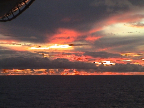 As we were doing
our evening walk, the sunset seemed to get more and more intense during
every lap. At this point, we ran inside to grab our cameras and I got
this picture, maybe just past the peak of the intensity. It looked like
the sky was on fire.
As we were doing
our evening walk, the sunset seemed to get more and more intense during
every lap. At this point, we ran inside to grab our cameras and I got
this picture, maybe just past the peak of the intensity. It looked like
the sky was on fire.
We got a notice this evening to set our clocks back yet another hour as we pass into a funny time zone that is GMT +12, I think. I'll get this date line thing figured out somehow, in the meantime, we're just setting the clocks by instruction without a true understanding of why.
Suva Fiji doesn't look like a very promising port. The ship's staff is constantly warning us NOT to take any valuables ashore. This looks to be a bad omen.
I finished the book on submarines and am working on one about the development of steam power in early America.
 It was raining very hard when we left the ship at
Suva, Fiji for a walk around town. However, we didn't get very far,
just to the tan building with the brown railings in the center of the
picture. The whole area is called the "market" and it was crowded and
chaotic. I had my back pockets brushed once, probably by a prospective
pickpocket and I wasn't feeling very good about being there. It was
noisy, crowded and felt very insecure. There were lots of young men
just standing around, I have no clue what they were up to, but it
probably wasn't in my best interest.
It was raining very hard when we left the ship at
Suva, Fiji for a walk around town. However, we didn't get very far,
just to the tan building with the brown railings in the center of the
picture. The whole area is called the "market" and it was crowded and
chaotic. I had my back pockets brushed once, probably by a prospective
pickpocket and I wasn't feeling very good about being there. It was
noisy, crowded and felt very insecure. There were lots of young men
just standing around, I have no clue what they were up to, but it
probably wasn't in my best interest.
 This is the scene at the furthest point of our
journey, which wasn't more than 100 yards from the exit of the
container terminal. Vendors had their produce just piled in the street,
some under tents, some not. We walked into a little store on that
corner, they had mostly textiles and then elected to return to the
ship. By the time that we got back, the rain had let up but we decided
not to press our luck and bid Suva goodbye.
This is the scene at the furthest point of our
journey, which wasn't more than 100 yards from the exit of the
container terminal. Vendors had their produce just piled in the street,
some under tents, some not. We walked into a little store on that
corner, they had mostly textiles and then elected to return to the
ship. By the time that we got back, the rain had let up but we decided
not to press our luck and bid Suva goodbye.
We sailed today about 5 minutes late because at the sail away time, the tour busses were still dragging in. The ship pulled away from the pier, turned in place 90° and headed straight out for a fairly narrow opening in the reef that forms the breakwater for Suva's harbor.
Just to confuse the time zone thing a little more, we'll be passing into New Zealand Daylight Time tonight so we "spring forward" (it's springtime here) an hour Sandy and I will be on this time for the next 4 weeks. This whole time thing is kind of a pain because I'm trying to keep my watch, computer, camera and PDA on local time. Sandy is trying to keep her stuff on PDT, except I have been setting her camera so that the dates come out right.
Shortly after we left, the cruise director came on the PA system to announce the "Suva Sail Away" party had been moved to Deck 11 (Lido) amidships, by the pool due the real chance of rain, it had been scheduled for Deck 10 aft. These "parties" are really a chance to sell overpriced drinks. Sandy got a Pina Colada a few nights ago at one of these parties. It cost $16.04 by the time that the tip was added in. She got to keep the coconut shaped covered cup that it came it, but $16 for one drink is pretty steep and she didn't even get much of a buzz. If one comes on a cruise with the intention of drinking, one had better bring lots of money. There are usually wines listed on the dinner menus that run between $30 and $60 a bottle.
Today is the first of two more days at sea before we reach New Zealand. We putz around the North Island for a few days and then the cruise ends in Auckland were we start Phase II, the land excursion of New Zealand.
We cleared New Zealand Immigration and Customs this morning with the NZ agents brought on the ship in Fiji. They were primarily interested in biohazards that might result in visitors bringing pests or agricultural diseases to New Zealand.
Melvyn Foster gave a talk on the mutiny on the Bounty, however from the perspective that Captain Bligh wasn't the real bad guy but a fairly tolerant Royal Navy skipper, such as they were. It was a perspective that wouldn't have made such a good movie but is probably, from the historical evidence, more correct.
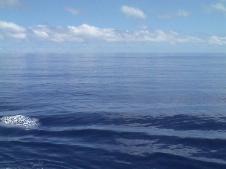 As we were
doing our after lunch walk, I noticed that the sea was almost
completely flat and that there were some flying fish about. It was
easier to see them without the swells and they could go quite a long
way before hitting a swell.
As we were
doing our after lunch walk, I noticed that the sea was almost
completely flat and that there were some flying fish about. It was
easier to see them without the swells and they could go quite a long
way before hitting a swell.
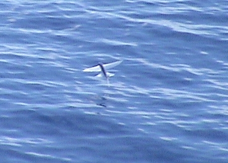 I went
inside and got my camera and waited. I finally caught some on "film" as
it were. These little buggers are hard to catch because they are small,
fast and unpredictable. I was using a telephoto setting so that I could
get any kind of resolution at all and it was really hard to find them
near the ship quickly enough to get a good picture before they got so
far away that they didn't show up in the pictures as more than a dot. I
got a video of one that was in the air for at least 28 seconds as he
was flying pretty much parallel to the ship and going in our direction.
Sometimes they will dip so low that their tail will leave a wake, but
they also use the tail in the water to make more speed so that they can
stay airborne longer. The photo is a link to a short movie of one of the longer runs.
I went
inside and got my camera and waited. I finally caught some on "film" as
it were. These little buggers are hard to catch because they are small,
fast and unpredictable. I was using a telephoto setting so that I could
get any kind of resolution at all and it was really hard to find them
near the ship quickly enough to get a good picture before they got so
far away that they didn't show up in the pictures as more than a dot. I
got a video of one that was in the air for at least 28 seconds as he
was flying pretty much parallel to the ship and going in our direction.
Sometimes they will dip so low that their tail will leave a wake, but
they also use the tail in the water to make more speed so that they can
stay airborne longer. The photo is a link to a short movie of one of the longer runs.
The weather has changed a little, it is no longer tropical, hot and humid, and has become temperate, cool, dry and windy. There is a considerable chop in the swell and some small whitecaps as the wind blows over the tops of the larger swells. We went for our after breakfast walk and the Lower Promenade Deck was crowded with traffic. This ship was running a "Walk for a Breast Cancer Cure" 5k and there were a couple of hundred people spread out around the deck doing 12 laps.
I had some date confusion this morning. My PDA said Tuesday while everything else said Monday. I used an elevator to verify the date. They change the carpet in the elevators every day and the carpets have the day of the week inscribed on them.
As we move further south toward a low pressure system, the weather has become even colder than it was this morning, the sea has become more choppy, the swell large and the wind stronger. I've ditched the sandals and started wearing a light jacket when on deck. In an unprotected area on deck, the wind is usually 30 mph or more with gusts much higher, enough to blow a standing person around. According to Navy guys at about 30 mph the wind will cause one's pant legs to flap. This is the necessary speed that the wind across the flight deck of an aircraft carrier has to be to launch and retrieve aircraft. This is why aircraft carriers need such big engines as they have to make a 30 mph+ wind even in still air.
We hit a couple of very large swells while I was pretty far forward and the vertical movement was pronounced. Our cabin is about amidships and near the centerline and fairly low so that we don't get the big linear movements from the ship's pitch or roll. Since the ship is a rigid body every body gets the angle. However, on the upper decks and far forward or aft those angles translate mostly into vertical (for pitch) or horizontal (for roll) movements as the ship rotates about it's center of mass.
The Bay of Islands was named by Captain Cook on his first voyage. The bay contains about 150 islands and is a well protected anchorage. There is no pier nearly large enough for a cruise ship so we used the tenders to go ashore. These are always a problem so we got up early and got on the first tender away from the boat. It took us quite a distance to a place called Waitangi. Then we caught a free shuttle bus to the main town, Paihia. From there we took a local ferry across the bay to another smaller town called Russell. The trip on our own to Russell took pretty much the whole morning.
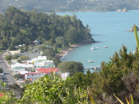 It turns out
that the Statendam was anchored about 500 yards from Russell, but we
had to go several miles to get there. Russell was the original European
settlement in New Zealand. Waitangi was the place that the treaty
between Britain and the Maori tribes was signed. For New Zealand, this
is an historic place. Russell rapidly degraded in to a wild west type
of town and it stayed that way for a long time. Now it is the upscale
neighborhood with houses running around $1M NZ and up. It is a very
quite and clean town, we really liked it. This picture is of the entire
extent of downtown Russell taken from a hill overlooking the town. The
hill itself is called Flagstaff hill because the British flag was
placed there and a disgruntled Maori chief chopped it down four times.
At one point, the British ships in the harbor mistook something going
on in Russell as a rebellion and fired cannon on the city. In the
confusion, somebody else dropped there lit pipe into the city's powder
magazine and blew the whole town up. The Maori chief was highly
impressed and pleased. This pretty much destroyed the town and it was
rebuilt as a much more civilized place.
It turns out
that the Statendam was anchored about 500 yards from Russell, but we
had to go several miles to get there. Russell was the original European
settlement in New Zealand. Waitangi was the place that the treaty
between Britain and the Maori tribes was signed. For New Zealand, this
is an historic place. Russell rapidly degraded in to a wild west type
of town and it stayed that way for a long time. Now it is the upscale
neighborhood with houses running around $1M NZ and up. It is a very
quite and clean town, we really liked it. This picture is of the entire
extent of downtown Russell taken from a hill overlooking the town. The
hill itself is called Flagstaff hill because the British flag was
placed there and a disgruntled Maori chief chopped it down four times.
At one point, the British ships in the harbor mistook something going
on in Russell as a rebellion and fired cannon on the city. In the
confusion, somebody else dropped there lit pipe into the city's powder
magazine and blew the whole town up. The Maori chief was highly
impressed and pleased. This pretty much destroyed the town and it was
rebuilt as a much more civilized place.
In the afternoon, we had booked a tour to the Glow Worm Caves. This is a limestone cave that has glow worms hanging from the ceiling. The cave is about 200 meters long and has worms along most of it's length. The worms themselves are a larval stage of some kind of fly and possess electroluminescence similar to a fire fly. They wouldn't allow us to take pictures in the cave because somebody always uses a flash and that startles the worms and the shut down. Besides, there were too dim to show up anyway. The cave ceiling did look like a starry night though.
 Then the
tour drove us across quite a bit of that part of New Zealand to the
Kauri forest. The Kauri tree is the 2nd largest tree in the world,
after the giant sequoia. This particular tree was one of the largest in
this forest. The tree was much favored by the Maori because the trunk
is nearly constant diameter and branch free for 100 feet or more and it
made an excellent starting point for a Maori war canoe. Most of these
trees are gone now, only about 3% of their habitat remains and all that
is left is protected.
Then the
tour drove us across quite a bit of that part of New Zealand to the
Kauri forest. The Kauri tree is the 2nd largest tree in the world,
after the giant sequoia. This particular tree was one of the largest in
this forest. The tree was much favored by the Maori because the trunk
is nearly constant diameter and branch free for 100 feet or more and it
made an excellent starting point for a Maori war canoe. Most of these
trees are gone now, only about 3% of their habitat remains and all that
is left is protected.
Our tour bus left late and it got back late. We were quite literally the last ones back on the boat.
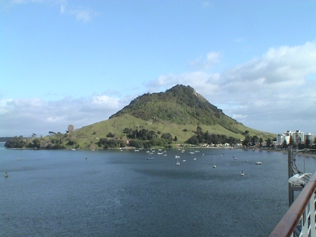 We
are docked at another container port in Mt. Maunganui. This is adjacent
to Tauranga, or the Bay of Plenty as Captain Cook named it. Apparently,
he found that the Maori had all they needed here in abundance, hence
the name. The mountain itself is the remainder of an extinct volcano.
It stands about 750 ft high and there are hiking trails to the top but
we're not going to try it because Sandy is bogged down with a light
cold.
We
are docked at another container port in Mt. Maunganui. This is adjacent
to Tauranga, or the Bay of Plenty as Captain Cook named it. Apparently,
he found that the Maori had all they needed here in abundance, hence
the name. The mountain itself is the remainder of an extinct volcano.
It stands about 750 ft high and there are hiking trails to the top but
we're not going to try it because Sandy is bogged down with a light
cold.
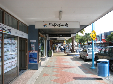 The main attractions here are not in town
proper, but at Rotorua which is some distance away. We're not going
there now because we've been there and we'll be there for more than a
day again on the land portion of our trip. Instead, we took a stroll
down the main shopping street in town. The street is neat, clean and
well organized with the typical collection of shops. I am finally
getting used to looking the other way when crossing a street, however
the drivers seem to go to great pains to stop for pedestrians. We're
just going to relax for the rest of the day.
The main attractions here are not in town
proper, but at Rotorua which is some distance away. We're not going
there now because we've been there and we'll be there for more than a
day again on the land portion of our trip. Instead, we took a stroll
down the main shopping street in town. The street is neat, clean and
well organized with the typical collection of shops. I am finally
getting used to looking the other way when crossing a street, however
the drivers seem to go to great pains to stop for pedestrians. We're
just going to relax for the rest of the day.
 The
ship behind us on the dock was loading up pallets for hours. Then more
trucks would come by and drop off more pallets. From the color of the
packaging and the fact that this area is a major kiwi growing region, I
assume that this is kiwi fruit.
The
ship behind us on the dock was loading up pallets for hours. Then more
trucks would come by and drop off more pallets. From the color of the
packaging and the fact that this area is a major kiwi growing region, I
assume that this is kiwi fruit.
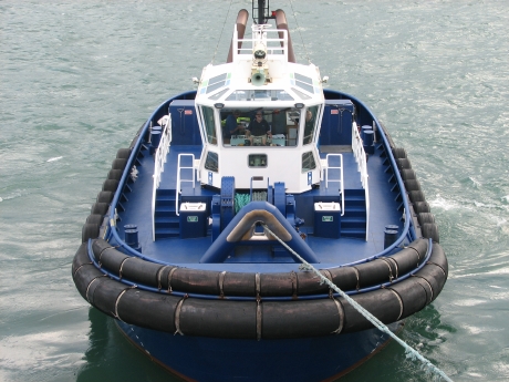 When we pulled
out, we had assistance from a couple of tugboats. This is the first
time that I am aware that the ship didn't pull out on it's own. It
appears that the exit channel is quite narrow and the tugs were there
to help us pull out and to make sure that we didn't overshoot into the
shallows in the center of the harbor. When this tug disconnected, he
came along side and bumped us to stop our outward movement.
When we pulled
out, we had assistance from a couple of tugboats. This is the first
time that I am aware that the ship didn't pull out on it's own. It
appears that the exit channel is quite narrow and the tugs were there
to help us pull out and to make sure that we didn't overshoot into the
shallows in the center of the harbor. When this tug disconnected, he
came along side and bumped us to stop our outward movement.
We stop by Napier today, but we get there at noon and leave at 1730. This leaves us only a few hours to wander around. There is a shuttle bus to the center of town, about 1.5 miles, and from there we will just walk around.
We had a late and large breakfast. Due to timing issues, we will skip lunch as we will be leaving the ship at about noon and we slept in until 0930.
We have definitely left the tropics, it was cold and windy on deck during our morning walk. If this weather holds up on the land portion of our trip, I'm going to have to buy a pair of gloves as I neglected to bring any.
 Napier
experienced a very large pair if earthquakes in 1931, both about 7.8
magnitude which essentially flattened the town. It also raised the
whole area by 8 feet so that what was shorefront became dry land. The
town was rebuilt mostly in the Art Deco style. This is the main stage
theater, "Cats" is playing now. It looked kind of odd to see all these
buildings in a style that was more than 75 years old.
Napier
experienced a very large pair if earthquakes in 1931, both about 7.8
magnitude which essentially flattened the town. It also raised the
whole area by 8 feet so that what was shorefront became dry land. The
town was rebuilt mostly in the Art Deco style. This is the main stage
theater, "Cats" is playing now. It looked kind of odd to see all these
buildings in a style that was more than 75 years old.
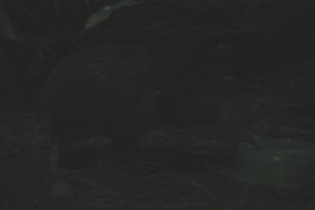 We took a shuttle to
the center of town and walked down the Marine Parade, a promenade that
parallels the coast, to the National Aquarium. It wasn't very large,
but it was very well done. One of the draws for us was the kiwi
exhibit. They have two birds, a brother and sister and we caught them
at feeding time so that the birds were out. Kiwis are nocturnal and
very fast so that they are not often seen except by folks that
specifically go looking for them. The exhibit was set to emulate
nighttime so that the light was very low, hence the very dark picture.
The kiwi is New Zealand's national bird and is actually a symbol for
the nation itself. New Zealander's are often called kiwis.
We took a shuttle to
the center of town and walked down the Marine Parade, a promenade that
parallels the coast, to the National Aquarium. It wasn't very large,
but it was very well done. One of the draws for us was the kiwi
exhibit. They have two birds, a brother and sister and we caught them
at feeding time so that the birds were out. Kiwis are nocturnal and
very fast so that they are not often seen except by folks that
specifically go looking for them. The exhibit was set to emulate
nighttime so that the light was very low, hence the very dark picture.
The kiwi is New Zealand's national bird and is actually a symbol for
the nation itself. New Zealander's are often called kiwis.
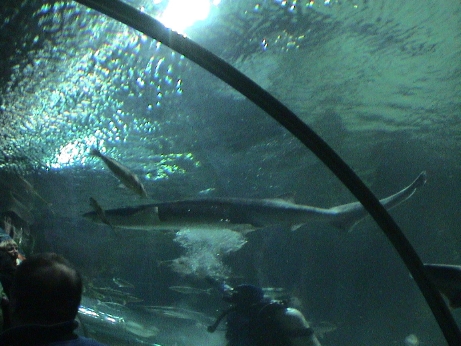 The aquarium also
has a walk through tube that allows the visitors an underwater view. It
was also feeding time here and a diver was feeding the occupants of the
tank.
The aquarium also
has a walk through tube that allows the visitors an underwater view. It
was also feeding time here and a diver was feeding the occupants of the
tank.
It was so cold and windy when we left the aquarium that we walked back to the bus stop and caught the shuttle back to the ship. The drive said that it was going to snow in the local mountains down to 700 meters, or about 2000 feet. This only happens in Los Angeles in the dead of winter. Here, it is early spring. I was wearing only a light jacket and when the wind was blowing, I was quite cold. After we got back to the ship I put on a woolen cap and a sweatshirt under my jacket and went up on deck in the wind. This made a significant improvement. Some long underwear, which I have, and a some gloves, which I don't have, will probably be adequate for the rest of the trip.
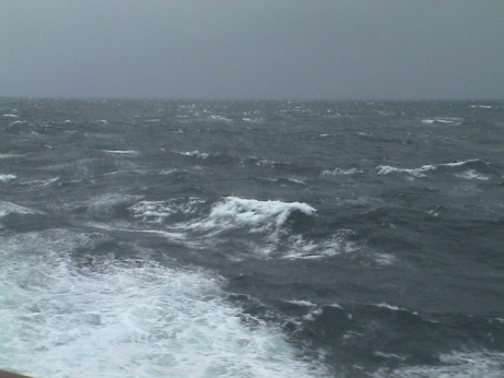 After we
left port, I noticed that the ship had a pronounced list to port.
However, as soon as I tried to go out on deck it became clear why. The
wind was literally blowing the ship over. There wasn't a lot of pitch
or roll, just a steady list. Later, the captain reported winds to 40 kt
and seas up to 20 ft. By that time we had some very significant and
more or less random ship movements with bangs and thumps as we plowed
into big swells. He strongly recommended that nobody should go out on
deck. I tend to agree, it would be unpleasant and unsafe.
After we
left port, I noticed that the ship had a pronounced list to port.
However, as soon as I tried to go out on deck it became clear why. The
wind was literally blowing the ship over. There wasn't a lot of pitch
or roll, just a steady list. Later, the captain reported winds to 40 kt
and seas up to 20 ft. By that time we had some very significant and
more or less random ship movements with bangs and thumps as we plowed
into big swells. He strongly recommended that nobody should go out on
deck. I tend to agree, it would be unpleasant and unsafe.
After a very choppy night we arrived at Wellington. Wellington sits on a very protected bay at the very southern most end of the north island. This is where the seagoing ferries depart for the trip to the south island. The ferries carry walk on traffic, cars, trucks and railroad cars. They are about half as big as the Statendam. Wellington is also the capital of the nation of New Zealand.
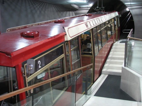 We walked from the cargo port toward
downtown, about a mile and a half away to the funicular railway that
leads up to a hill overlooking Wellington. This is also the location of
the botanic gardens.
We walked from the cargo port toward
downtown, about a mile and a half away to the funicular railway that
leads up to a hill overlooking Wellington. This is also the location of
the botanic gardens.
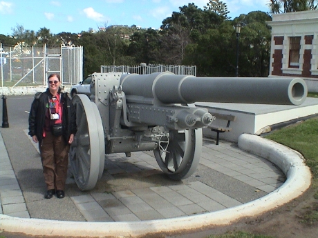 We didn't
walk through most of the gardens because the area is quite large and
hilly, but we did walk over to a couple of observatories and the Krupp
gun. This was manufactured in Germany before WW1 and was captured by
the Kiwis and returned as a war trophy. The sign indicates that this
one is the last of this type known to exist of 190 built. This was also
the location of a gun battery built in 1904 to protect the harbor from
Japanese attack, however these batteries are long gone.
We didn't
walk through most of the gardens because the area is quite large and
hilly, but we did walk over to a couple of observatories and the Krupp
gun. This was manufactured in Germany before WW1 and was captured by
the Kiwis and returned as a war trophy. The sign indicates that this
one is the last of this type known to exist of 190 built. This was also
the location of a gun battery built in 1904 to protect the harbor from
Japanese attack, however these batteries are long gone.
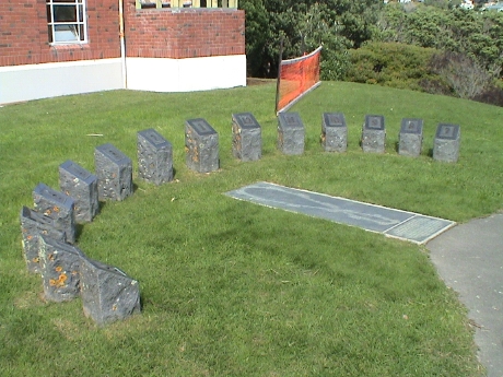 This sundial
near the observatories requires that one stand on a brass plaque marked
with a figure 8 shape and stand on the current day as marked. Then you
hold your hand over your head and the shadow falls across the time. It
worked, then I realized that it was DST and I was temporarily confused
until I read the signs that says that the stones are rest twice a year
to compensate for daylight savings time.
This sundial
near the observatories requires that one stand on a brass plaque marked
with a figure 8 shape and stand on the current day as marked. Then you
hold your hand over your head and the shadow falls across the time. It
worked, then I realized that it was DST and I was temporarily confused
until I read the signs that says that the stones are rest twice a year
to compensate for daylight savings time.
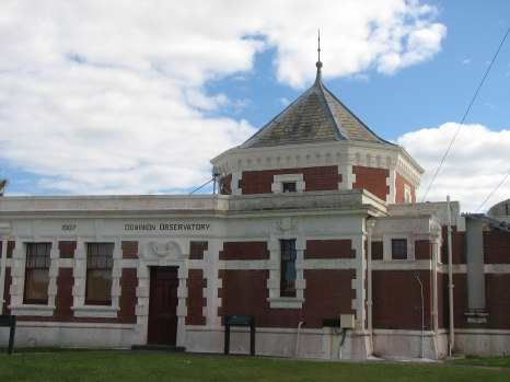 This observatory was built to take star
sightings to determine the national time. The doors at the right, and
other on the roof, opened to allow a north-south slit to be opened to
determine the time when certain stars passed directly overhead. It was
accurate to 0.25 seconds. The time markers were indicted by colored
lights placed so that they could be seen from all over town. The time
signals were then transmitted to the rest of the nation by
telegraph.
This observatory was built to take star
sightings to determine the national time. The doors at the right, and
other on the roof, opened to allow a north-south slit to be opened to
determine the time when certain stars passed directly overhead. It was
accurate to 0.25 seconds. The time markers were indicted by colored
lights placed so that they could be seen from all over town. The time
signals were then transmitted to the rest of the nation by
telegraph.
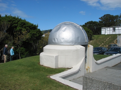 This small dome contained an instrument that was
used during the International Geophysical Year in 1958 to make star
sightings to determine the exact position of the instrument. This is
the most carefully surveyed spot on the islands.
This small dome contained an instrument that was
used during the International Geophysical Year in 1958 to make star
sightings to determine the exact position of the instrument. This is
the most carefully surveyed spot on the islands.
We then walked back to the shorefront to the Wellington City Museum. This was built in the former customs house. This museum was very well done and highly focused on the history of the Wellington area. After that, we walked back to the ship. We had lunch and then Sandy immediately crashed.
We'll have another full day in Wellington on the land portion of our trip. There is another large museum, the Te Papa, that Sandy wants to see then.
The cruise portion of our trip is winding down, we have the rest of the day at Wellington, we are staying on the ship. Tomorrow is a sea day, we will sail back around the eastern side of the north island and approach Auckland from the east. We will dock early on the day after tomorrow, Sunday, October 21, 2007 and then disembark and find our way to our first hotel. The land itinerary goes something like the table below unless we find that changes have been made when we pick up our travel vouchers at the hotel.
| Day | Date | Location | Travel Method | Notes |
|---|---|---|---|---|
| 25 | 21 Oct 07 | Auckland Copthorne Anzac Hotel | TBD | We find our own way to the hotel, check in and have the rest of the day free |
| 26 | 22 Oct 07 | Auckland Waitomo Rotorua |
motor coach | Tour Waitomo Caves, then on to Rotorua |
| 27 | 23 Oct 07 | Rotorua | n/a | Visit Te Puia Village, Rainbow Springs, Agrodome today |
| 28 | 24 Oct 07 | Rotorua Wellington |
motor coach | The balance of the day in Wellington is free |
| 29 | 25 Oct 07 | Wellington | n/a | Te Papa Museum, balance of the day is free |
| 30 | 26 Oct 07 | Wellington Picton Christchurch |
Ferry Train |
Travel most of the day, hotel in Christchurch |
| 31 | 27 Oct 07 | Christchurch | n/a | At leisure |
| 32 | 28 Oct 07 | Christchurch Mount Cook Queenstown |
motor coach | Cross the Southern Alps |
| 33 | 29 Oct 07 | Milford Sound | coach cruise coach |
Cruise Milford Sound |
| 34 | 30 Oct 07 | Queenstown | n/a | Explore Queenstown |
| 35 | 31 Oct 07 | Queenstown | tbd | Explore Queenstown |
| 36 | 1 Nov 07 | Queenstown Franz Josef |
motor coach | West coast of the southern island |
| 37 | 2 Nov 07 | Franz Josef Greymouth Christchurch |
motor coach train |
travel back to Christchurch |
| 38 | 3 Nov 07 | Christchurch Wellington |
train ferry |
Travel to Wellington |
| 39 | 4 Nov 07 | Wellington Auckland |
train | Travel to Auckland |
| 40 | 5 Nov 07 | Auckland | TBD | More time in Auckland, get back a day early just to be sure that we can make the flight out on 6 Nov 07 |
| 41 and 42 | 6 Nov 07 | Auckland Sydney Honolulu Lihu'e |
air | Fly back across the International Date Line. The day that vanished on the way out returns and makes 6 Nov 2 days long. |
We slept in to about 1000 this morning and got a very late breakfast. A late lunch and a later dinner is in the plan. Today is a sea day, we backtrack up the east coast of New Zealand to approach Auckland tomorrow morning. We did our laundry last night and will pack after dinner tonight. In 24 days, our stuff is scattered all over our cabin so it will take time to locate it all again, paying careful attention to leaving out the clothes that we will wear tomorrow.
We will be off the ship by about 1000 on Oct 21 and we will have find our own way to our first hotel to begin the land leg of the trip. According to the maps, the Copthorne Anzac is about a mile from the Princess Wharf where the ship will dock. We figure that we'll walk to the hotel. Cities aren't your best tourist destinations, they are expensive and offer little in the way of scenery. However, some of them have good museums and we plan to visit several during the two short stays in Auckland. They are the War Memorial Museum, the Maritime Museum and Kelly Tarlton's Antarctic Encounter and Underwater World.
Snow was forecast on the night that we left Napier. I guess that it happened because all of the higher peaks on the eastern shore are snowcapped. The sea is pretty calm right now, just a small amount of ship movement, nothing at all like the last time we were here. It is cold though, about 50°F. We don't expect that to change much until we get to the south island where it will probably be colder.
The ship arrived in Auckland this morning at about 0800. The ship was cleared by 0815 and they kicked us off at 0830. There we were, standing at on the Princess Wharf in a new city. Fortunately, I had a Google map to our hotel. We elected to hoof it about a mile to the hotel. They actually checked us in at about 0930.
The day before yesterday, Sandy left her jacket somewhere on the ship and it did not show up in the lost and found by the time that we left so that Sandy was without a warm jacket. Fortunately, it wasn't really cold, about 60°F, so that her light jacket was good enough. However, we ventured out, back nearly to where the ship was docked to look for a replacement. We found a backpacker's store that had really good stuff but at really high prices, a jacket that was similar to the one that she lost would run about $360 US. We found another department store but they'd sent all their cold weather gear back, it's springtime here. She settled for a $15 US pullover rain jacket over her light jacket for the time being. We'll keep looking for a reasonable real jacket later.
That trip amounted to another 1.7 miles of walking. By that time it was about lunchtime. I could see a Subway from our hotel balcony so we walked down there for sandwiches. We walked a little further on into the Auckland Domain heading for the War Museum but Sandy wanted to go to another place, Kelly Tarlton's Extreme Antarctica, instead so we turned around and walked back to the hotel and caught a cab to about 4 miles out of town.
 The place wasn't very big, there was a penguin
exhibit, an exhibit of Scott's Antarctic Expedition, a walk through
shark tank, a walk through fish tank and a few other exhibits. This is
a King Penguin.
The place wasn't very big, there was a penguin
exhibit, an exhibit of Scott's Antarctic Expedition, a walk through
shark tank, a walk through fish tank and a few other exhibits. This is
a King Penguin.
 I didn't see it until I looked at the
photo, but this Gentoo Penguin is caring for an egg.
I didn't see it until I looked at the
photo, but this Gentoo Penguin is caring for an egg.
We spent a couple of hours there and then got a cab back to the hotel. I then walked back down to the Subway, which was also a gas station and mini-mart and got some more munchies, that with the other parts of our lunch sandwiches, will make our dinner. They had one meat pie left, it was pretty good and hit the spot.
All day we had been dealing with a car insurance problem. The carrier had cancelled it because of a auto-payment issue that occurred because of our retirement. They cancelled our coverage without telling us. It was nearly a month before they got around to notifying us. I needed to call them to authorize reinstatement, but their number wouldn't work from NZ. Finally, I got my son to request that they call me on the cellphone and late in the afternoon, we got it straightened out and reinstated.
The hotel has internet access, wired in the room for $0.68 NZ/min, or wireless in the lobby for $5 NZ for 30 min. After I had purchased, and used, most of the 30 min, I found that there were internet shops nearby that sold internet time for as little as $2/hour. We'll have to scout for internet cafes a little more carefully around our hotels for the rest of the trip.
It was up early this morning to catch a tour bus to Rotorua with a stop by the Waitomo Glow Worm Caves on the way. Actually, the cave leg added about 3 hours to the journey so it was pretty much out of the way. It was overcast and very windy when we left Auckland and it started to rain just about the time that we left the city and it continued to rain off and on until almost the end of the journey. The wind was blowing so hard at times that it was pushing the bus around. Most of the countryside that we saw in the first hour looked like parts of the central California coast, rolling hills covered in grass and a quite a few trees.
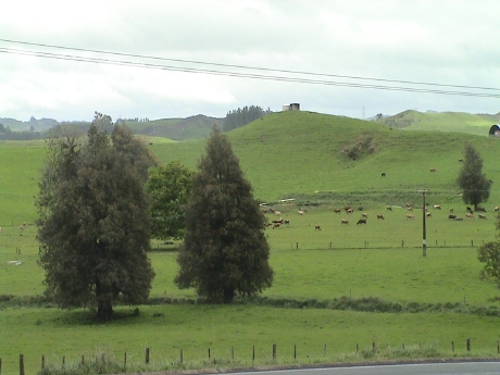 Further south, in Maori country, the
scenery was like this, hills and pastures with cattle, dairy cows or
some some sheep. Everything was green.
Further south, in Maori country, the
scenery was like this, hills and pastures with cattle, dairy cows or
some some sheep. Everything was green.
We weren't allowed to take any photos in the caves themselves, but they were pretty typical of limestone caves, lots of formations and some large rooms. However, this one has an active river running through it and in one partly flooded chamber, the glow worm grotto, there were thousands of them packed onto the ceiling in an area of maybe only 200 square feet. It did look like a starry night. The tour in this part of the cave was in a boat.
We then got back on the bus and stopped nearby for lunch (where the last picture was taken) and then headed to Rotorua via a whole maze of back roads that were not on the maps that we had. I am glad that I was not navigating.
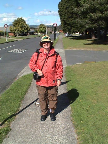 By
the time that we got to Rotorua, the clouds had broken and it got warm
enough to walk around without a jacket. But Sandy was still wearing the
new one that she found, at an oyster stand of all things, on the way
down. We had stopped for morning tea. Next to the tea shop was a stand
selling oysters. Adjoining and behind it was a gift shop that had these
lined jackets for a somewhat high but reasonable, for New Zealand
anyway, price. Everything seems to cost about twice as much in New
Zealand as in the US, however sales tax is included. I do not know the
rate. When this picture was taken we were on a walk from our hotel in
Rotorua to a supermarket about a mile away to buy a small amount of
food that we could avoid paying for highly overpriced meals in the
hotel as there were no restaurants nearby.
By
the time that we got to Rotorua, the clouds had broken and it got warm
enough to walk around without a jacket. But Sandy was still wearing the
new one that she found, at an oyster stand of all things, on the way
down. We had stopped for morning tea. Next to the tea shop was a stand
selling oysters. Adjoining and behind it was a gift shop that had these
lined jackets for a somewhat high but reasonable, for New Zealand
anyway, price. Everything seems to cost about twice as much in New
Zealand as in the US, however sales tax is included. I do not know the
rate. When this picture was taken we were on a walk from our hotel in
Rotorua to a supermarket about a mile away to buy a small amount of
food that we could avoid paying for highly overpriced meals in the
hotel as there were no restaurants nearby.
Rotorua is sort of a playground in the north east part of the north
island. We are going to tour some of these tomorrow. There are lots of
of things to do there, all of them cost money somehow. The are is also
the location of the geothermal areas, which we visit tomorrow. The
large lake contains very large trout, some more than 3 ft long. I saw
some of these the last time that we were here about 20 years ago.
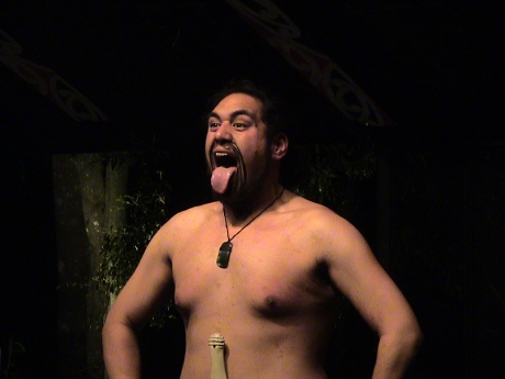 However, tonight, we went to a Hangi feast at a
recreated Maori village. This was quite a process. First we were picked
up in a bus from the hotel. Then we drove all over town picking up
other people. Then we were taken to a ticket office so that the folks
that hadn't paid already could pay up. I don't know what it cost, it
was bundled into our tour. Then we were taken through an audio/visual
presentation in three different sets to give us some history of the
Maori people. Then we got back on the bus and were driven about 10
miles out of town into the forest to the Maori village set. We got some
demonstrations of Maori life and then we were herded into a concert
hall for some more Maori demonstrations, song and dance. This is where
this photo came from. The Maori stuck out there tongues as a display of
defiance, typically before battle. The people that were participating
in this demonstration were all Maori. Then it was time for dinner. This
whole process had taken nearly three hours and I was hungry.
However, tonight, we went to a Hangi feast at a
recreated Maori village. This was quite a process. First we were picked
up in a bus from the hotel. Then we drove all over town picking up
other people. Then we were taken to a ticket office so that the folks
that hadn't paid already could pay up. I don't know what it cost, it
was bundled into our tour. Then we were taken through an audio/visual
presentation in three different sets to give us some history of the
Maori people. Then we got back on the bus and were driven about 10
miles out of town into the forest to the Maori village set. We got some
demonstrations of Maori life and then we were herded into a concert
hall for some more Maori demonstrations, song and dance. This is where
this photo came from. The Maori stuck out there tongues as a display of
defiance, typically before battle. The people that were participating
in this demonstration were all Maori. Then it was time for dinner. This
whole process had taken nearly three hours and I was hungry.
A Hangi is a Maori feast. The feast is prepared by digging a pit, heating volcanic stones on a wood structure above the pit until they were white hot and letting them collapse into the put. Then the food was wrapped in wet baskets and dropped into the pit and then quickly covered and sealed to contain the steam. After 3 or 4 hours, it is dug up and presented as dinner. We had mussels, chicken and lamb. There was a kind of a pudding/cake cooked in the Hangi as well, but I was so full by that time, I didn't try it. The was a root, similar to a potato, in the mix as well, it was actually pretty good. This was not taro, but something that grew here in New Zealand before the Maori came. By the time we got back to the hotel, it was after 2300.
Today, we went on a tour to three local sites in Rotorua, the Te Puia Maori cultural site, Rainbow Springs, a wildlife sanctuary, and the Agrodome, a sheep shearing demonstration.
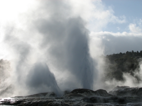 Te Puia was the
site of a Maori settlement that is in an active thermal field. This is
their main draw, a geyser that runs for hours at a time. They said that
at one point a few years ago, it played continuously for 200 days. The
site is built up into a full scale tourist draw. It also has the
typical boiling pools, mud pots and steam vents. There is also a tribe
meeting house, also used for concerts, a wood carving school and a
weaving school.
Te Puia was the
site of a Maori settlement that is in an active thermal field. This is
their main draw, a geyser that runs for hours at a time. They said that
at one point a few years ago, it played continuously for 200 days. The
site is built up into a full scale tourist draw. It also has the
typical boiling pools, mud pots and steam vents. There is also a tribe
meeting house, also used for concerts, a wood carving school and a
weaving school.
The Maori tribe that lived in this area did Hangi cooking as well, but they used geothermal steam instead of hot rocks.
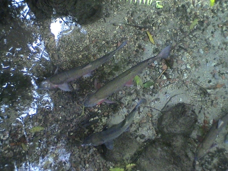 Rainbow Springs is a site in a forested area
very near the lake. The British introduced rainbow and other trout into
the lake in the 1880's for sport fishing. Little did they know that the
fish would like the lake a lot and grow VERY large. These wild trout
are about 2 ft long. This stream runs down from the mountains directly
to the lake and the fish come here because they are fed in the Rainbow
Springs ponds and pools. They can return to the lake anytime the
please. When I was here in 1987 while driving by the lake on the
southeast shore, I saw a fisherman carrying two trout by their gills.
Their tails were dragging on the ground. The limit is three fish and,
by law, they cannot be sold. Therefore there is no commercial fishing
on the lake and the trout population does not get fished out.
Rainbow Springs is a site in a forested area
very near the lake. The British introduced rainbow and other trout into
the lake in the 1880's for sport fishing. Little did they know that the
fish would like the lake a lot and grow VERY large. These wild trout
are about 2 ft long. This stream runs down from the mountains directly
to the lake and the fish come here because they are fed in the Rainbow
Springs ponds and pools. They can return to the lake anytime the
please. When I was here in 1987 while driving by the lake on the
southeast shore, I saw a fisherman carrying two trout by their gills.
Their tails were dragging on the ground. The limit is three fish and,
by law, they cannot be sold. Therefore there is no commercial fishing
on the lake and the trout population does not get fished out.
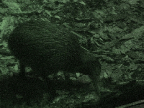 Rainbow Springs
also has a kiwi exhibit. This one was better lit that the other one so
that I got some slightly better pictures. This one kiwi was running all
around the enclosure looking for food and it was really hard to get a
picture while he was stand still. In this enclosure, they scatter it's
food all around so that it has to look for it's food.
Rainbow Springs
also has a kiwi exhibit. This one was better lit that the other one so
that I got some slightly better pictures. This one kiwi was running all
around the enclosure looking for food and it was really hard to get a
picture while he was stand still. In this enclosure, they scatter it's
food all around so that it has to look for it's food.
 Our third stop was at the Agrodome. This
was primarily a sheep exhibit. Sheep may not seem very interesting, but
in New Zealand, sheep are a very big deal. Even a mundane subject can
be made interesting with proper presentation and these guys did a
credible job of making an interesting show out of a less than
interesting subject. These sheep were trained to climb up on this stand
for display of the various breeds. Then a sheep was brought on stage
and sheared, it took about 2 minutes. The presenter said that the
record for shearing sheep was over 1000 in a 9 hour shift, or less than
a minute each. There also was a demonstration outside of 2 sheep dogs
herding some sheep into a pen.
Our third stop was at the Agrodome. This
was primarily a sheep exhibit. Sheep may not seem very interesting, but
in New Zealand, sheep are a very big deal. Even a mundane subject can
be made interesting with proper presentation and these guys did a
credible job of making an interesting show out of a less than
interesting subject. These sheep were trained to climb up on this stand
for display of the various breeds. Then a sheep was brought on stage
and sheared, it took about 2 minutes. The presenter said that the
record for shearing sheep was over 1000 in a 9 hour shift, or less than
a minute each. There also was a demonstration outside of 2 sheep dogs
herding some sheep into a pen.
We then got back on the bus for a ride into down. We got off downtown, about a mile and a half from our hotel, and found an internet cafe. Charlie had called on the cell phone with news that there were wildfires all over California and that Green Valley Lake was burning and at least 20 homes had been lost. At this point we do not know the status of our cabin, he'll call back when he finds anything out. The information on the internet was not too enlightening but it didn't sound good but there is nothing we can do about it at this point.
We then found a local bakery and got some meat pies for lunch and then walked back to the hotel and both of us fell asleep until evening.
Today was a travel day. We got on a small shuttle van to take us to the bus station in Rotorua, then we got on a large coach for the trip to Wellington which took 8 hours. Then we got on another shuttle that was waiting for us to get to our hotel. The tour company set all these connections up in advance.
Traveling on a tour bus usually occurs during the day which takes away from sightseeing time. Traveling on a cruise ship usually happens at night but you are generally stuck in a port or going on rather expensive ship sponsored tours. One can always book a private tour, but if a private tour comes back late, the ship sails without you. They will hold the ship for ship sponsored tours.
However, the day is not all lost. We got to see a lot of the New Zealand countryside, which included lots of cows, forests and sheep. The most important exports of New Zealand are dairy products, wood products and sheep products in that order. This is no coincidence.
Leaving Rotorua up the thermal plateau lead us past a bunch of thermal features and a geothermal power plant, a really big one. As we climbed higher, we left the farmland and the forests became more dense and then we entered the Lake Taupo region. This is the largest lake in New Zealand. The area around it is built up for lake activities, especially fishing. I saw large trout in the streams and rivers leading into the lake as we crossed over bridges. If I could pick out large fish from a moving bus along one side of a bridge, then there are probably lots of them around. The driver indicted that the estimated trout population of the lake exceeds a billion fish.
 After
leaving the lake district, we climbed to the high desert at an
elevation of about 3000 ft. Dominating the region are two large, and
still active, volcanos. This is the largest mountain on the north
island, Mt. Ruapehu. We have climbed above the local tree line and all
that grows here is scrub. This scene looks very similar to the south
end of the Owens Valley in California.
After
leaving the lake district, we climbed to the high desert at an
elevation of about 3000 ft. Dominating the region are two large, and
still active, volcanos. This is the largest mountain on the north
island, Mt. Ruapehu. We have climbed above the local tree line and all
that grows here is scrub. This scene looks very similar to the south
end of the Owens Valley in California.
 On the southern
portion of the high desert, I saw a bunch of what looked like motor
bike park trails, except they were deeper and wider. It seems that the
New Zealand army uses this area for tank training. This display tank is
at the Army Museum at Waiouru or nearby. There are also wild horses on
the desert. These are the descendants of horses released by the army
when it converted more to mechanized operations and didn't need the
horses. The army released them instead of shooting them and they have
survived too well. The herd needs to be culled annually.
On the southern
portion of the high desert, I saw a bunch of what looked like motor
bike park trails, except they were deeper and wider. It seems that the
New Zealand army uses this area for tank training. This display tank is
at the Army Museum at Waiouru or nearby. There are also wild horses on
the desert. These are the descendants of horses released by the army
when it converted more to mechanized operations and didn't need the
horses. The army released them instead of shooting them and they have
survived too well. The herd needs to be culled annually.
After descending from the high desert, the landscape turned back into farmland and forest until we got to the outskirts if Wellington, where it started to look like Orange County.
By the time that we arrived in Wellington it was cold and getting very windy. We had gone out looking for dinner and an internet cafe to check on the progress of the Slide Fire in Green Valley and to buy some food for breakfast. By the time that we got back to the hotel, the wind was pretty strong and very cold.
Tomorrow, we tour the Te Papa Museum in Wellington. This is the national museum of New Zealand and it is about a block away from the hotel.
We still can't be sure of the status of our cabin, the fire maps for the Slide Fire show that the fire had burned completely around Green Valley Lake, with some houses on the north edge burned. A finger had shot off to the southwest and burned a bunch of houses in Running Springs. Containment was 0% and we don't know if the perimeter around Green Valley is active or not. Our son, Charlie, who is at home, says that the skies over Los Angeles are blood red because of the smoke. There is still some threat to Cal Poly Pomona where another son, Zack, is living. This is a really big deal as nearly a million people in Southern California are either under evacuation notice or could be evacuated shortly and hundreds of homes have burned already.
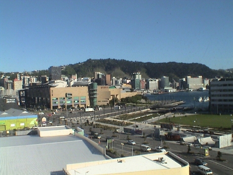 Our target for
today is the Te Papa Museum which is clearly visible at the left of
this photo taken from our hotel room. Downtown Wellington is in the
background. The tour starts at 1015 so we could actually sleep in
today. This will probably be a luxury on this trip because most days,
we are either traveling or starting an early.
Our target for
today is the Te Papa Museum which is clearly visible at the left of
this photo taken from our hotel room. Downtown Wellington is in the
background. The tour starts at 1015 so we could actually sleep in
today. This will probably be a luxury on this trip because most days,
we are either traveling or starting an early.
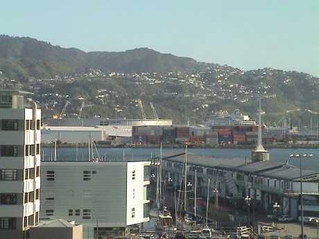 Looking a little further east, the ms Statendam is
tied up to the same pier next to the sports stadium. While we were
traveling overland, the ship was backtracking down the east coast of
New Zealand. The night that we spent in Auckland, it would have headed
back to the Bay of Islands. The first night that we spent in Rotorua,
the ship was traveling to Tauranga which is only a few miles from
Rotorua. We saw some of the ship's staff at the Agrodome. The 2nd night
that we spent at Rotorua it would have been traveling to Napier. Today,
it is here in Wellington. Tomorrow, we take the inter island ferry to
Picton and a train to Christchurch on the south island. The ship should
be there too. At that point, we go inland and it heads further south to
Dunedin, then off to Australia. We may see it again in Christchurch,
but that will be the last time on this trip.
Looking a little further east, the ms Statendam is
tied up to the same pier next to the sports stadium. While we were
traveling overland, the ship was backtracking down the east coast of
New Zealand. The night that we spent in Auckland, it would have headed
back to the Bay of Islands. The first night that we spent in Rotorua,
the ship was traveling to Tauranga which is only a few miles from
Rotorua. We saw some of the ship's staff at the Agrodome. The 2nd night
that we spent at Rotorua it would have been traveling to Napier. Today,
it is here in Wellington. Tomorrow, we take the inter island ferry to
Picton and a train to Christchurch on the south island. The ship should
be there too. At that point, we go inland and it heads further south to
Dunedin, then off to Australia. We may see it again in Christchurch,
but that will be the last time on this trip.
From the commentary of the various bus drivers on the way here from Auckland and the stuff that we saw on the TV last night and some of the exhibits on the Te Papa, it is clear that New Zealand has gone somewhat over the top on the "green" thing. This may be, overall, a good thing but this is a small country and for New Zealand to absorb the economic load that being green entails, they may not be able to handle it.
New Zealand generates well over 2/3 of it's electricity from hydro, geothermal and wind. Some hydro power is generated on the south island and then transmitted via undersea cables and overland transmission lines all the way to Auckland. Coal is still mined here, but all of it is exported. It is no longer consumed here. There is a large gas fired power plant south of Auckland. There are also no nukes, either in the form of power plants, research reactors or weapons. New Zealand will not allow any visiting ships that are nuclear powered or carry nuclear weapons.
We took our one hour guided tour of the Te Papa and then wandered around for another hour and a half on our own. However, we were hungry and so we walked back by the supermarket on the way to the hotel and bought some lunch stuff to take back to our room in the hotel.
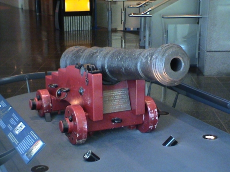 After lunch and a rest, it was back to the Te Papa.
This is a cannon that was thrown overboard from Captain Cook's
Endeavour when it ran aground on the Great Barrier Reef during his
first voyage. One of ship's lecturer's, Melvyn Foster, had mentioned
that he had seen this cannon at the Te Papa when the ship was in
Wellington, and being a history nut, he was ecstatic to see it.
After lunch and a rest, it was back to the Te Papa.
This is a cannon that was thrown overboard from Captain Cook's
Endeavour when it ran aground on the Great Barrier Reef during his
first voyage. One of ship's lecturer's, Melvyn Foster, had mentioned
that he had seen this cannon at the Te Papa when the ship was in
Wellington, and being a history nut, he was ecstatic to see it.
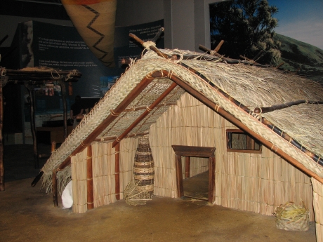 The
place was so big that selecting a few pictures to post was a difficult.
However, this Maori house caught my eye. It was almost entirely made
from light wood members and flax. The doorway is small so that it would
be easier to cover to keep the weather out. Also, the house would
usually be built over a pit so that it was partially below ground where
the soil would allow it. The house was fairly well insulated by the
thick fiber walls and was heated with hot stones that were carried
inside from a communal fire kept going outside or heated by steam in
thermal areas.
The
place was so big that selecting a few pictures to post was a difficult.
However, this Maori house caught my eye. It was almost entirely made
from light wood members and flax. The doorway is small so that it would
be easier to cover to keep the weather out. Also, the house would
usually be built over a pit so that it was partially below ground where
the soil would allow it. The house was fairly well insulated by the
thick fiber walls and was heated with hot stones that were carried
inside from a communal fire kept going outside or heated by steam in
thermal areas.
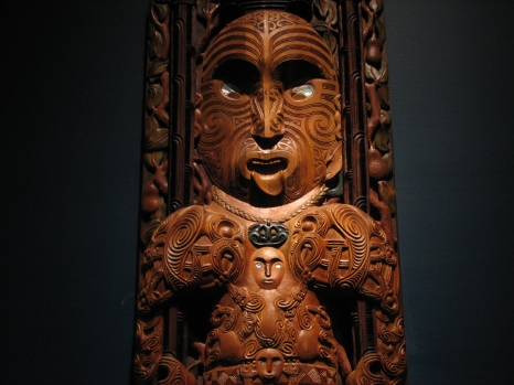 The Maori excelled at wood carving, but much of the
carving was very stylized. These kinds of carvings would decorate the
houses of the high born members of the tribe and the tribe's communal
buildings.
The Maori excelled at wood carving, but much of the
carving was very stylized. These kinds of carvings would decorate the
houses of the high born members of the tribe and the tribe's communal
buildings.
We became tired again late in the afternoon and returned to the hotel. As it got to be dinner time, we walked to an internet cafe to check the net and then went by the store again for some steak pies.
There was no real news about the status of Green Valley Lake, but the Slide Fire site indicated that the eastern front of the fire was quiet. However, The Dominion Post, a newspaper here in Wellington, featured a large picture of a burning house in Green Valley Lake. This could have been from the first day of the fire. There were pictures all over the net of burning houses in Running Springs.
Tomorrow, we get on the ferry and should be in Christchurch by tomorrow evening.
We've been in Wellington for three nights now, once on the ship and twice in this hotel, and every evening the wind comes up and it gets really cold. The weather has been nice during the day and it is comfortable in the sun, but when the wind chill kicks in, it is pretty miserable outside. The wind as we came back in about two hours ago was at least 30 mph and I think that it is gusting higher than that now based on the wind noise outside of our window. I am very glad to be indoors in a heated room right now. We're headed south, deep into the roaring 40's, and it's just going to get colder.
 It's
still pretty early in the morning, but we've made it on to the
InterIsland Ferry to Picton. This is a oceangoing car carrier, it's
built like a regular ship. Most of the seating is airline type
reclining seats. The seas were listed as moderate, but actually, the
Cook Strait was quite tame and the 3 hour crossing was smooth.
It's
still pretty early in the morning, but we've made it on to the
InterIsland Ferry to Picton. This is a oceangoing car carrier, it's
built like a regular ship. Most of the seating is airline type
reclining seats. The seas were listed as moderate, but actually, the
Cook Strait was quite tame and the 3 hour crossing was smooth.
 This is a poster of the ferry itself. I would guess
that it is about 500 feet long and about 100 feet wide. The passengers
have the run of two decks forward of amidships and some outer decks.
Cars, trucks and some railroad cars are secured on 3 decks below.
This is a poster of the ferry itself. I would guess
that it is about 500 feet long and about 100 feet wide. The passengers
have the run of two decks forward of amidships and some outer decks.
Cars, trucks and some railroad cars are secured on 3 decks below.
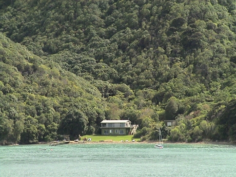 The last third of the passage is down a long
sound at the north end of the south island. All along the sound, there
are houses, like this one, tucked into little bays. There is a road
running down this side of the sound, but the other side does not appear
to have a road so that access would be by boat only.
The last third of the passage is down a long
sound at the north end of the south island. All along the sound, there
are houses, like this one, tucked into little bays. There is a road
running down this side of the sound, but the other side does not appear
to have a road so that access would be by boat only.
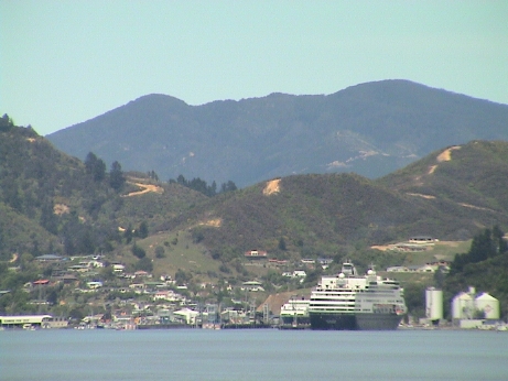 When we got to Picton, the ms Statendam was tied
up to a pier. We expected it to be in Christchurch, but it appears that
it will get there tomorrow. Picton isn't a very big town, you're
looking at all of it. We walked 200 meters from the ship to the train
station and waited for the Tranz Coastal train to Christchurch.
When we got to Picton, the ms Statendam was tied
up to a pier. We expected it to be in Christchurch, but it appears that
it will get there tomorrow. Picton isn't a very big town, you're
looking at all of it. We walked 200 meters from the ship to the train
station and waited for the Tranz Coastal train to Christchurch.
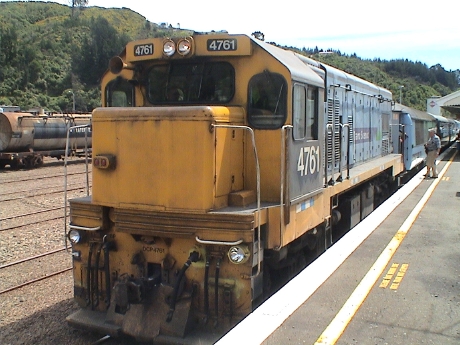 The train showed up and we started our 6 hour ride
to Christchurch. This is a narrow gauge railway built with heavy gauge
rail and mostly concrete ties. Even so, the ride was pretty rough, we
bounced around quite a bit. Narrow gauge trains normally don't go
really fast, but this one got up to at least 60 mph in places.
The train showed up and we started our 6 hour ride
to Christchurch. This is a narrow gauge railway built with heavy gauge
rail and mostly concrete ties. Even so, the ride was pretty rough, we
bounced around quite a bit. Narrow gauge trains normally don't go
really fast, but this one got up to at least 60 mph in places.
The scenery was pretty much the same as on the north island. Most of the coastal route is through farmland, however there is a stretch right along the coast. We passed a seal rookery but I only saw a few seals and maybe I got a photo of one, but it wasn't a good photo. It's hard taking good photos through the windows of a moving train. There was an open observation car but it was cold and windy so I didn't stay out there very much.
After arrival in Christchurch, we were met by a shuttle service that took us to our hotel somewhere away from the city center. I have to check out some maps to figure out exactly where we really are. We have the day free tomorrow and we haven't decided how to spend it.
Last night, we walked a short way from the hotel looking for something to eat. There were lots of places, we ended up at a place called Burger Wisconsin. It was a pretty good hamburger. There was no internet cafe that we could see so we used the terminal in the hotel lobby to check email and the fire's progress.
It's not looking good for the cabin. The new fire maps show that the fire has entered Green Valley Lake proper, but the scale was not good enough to see exactly where it had burned. I called a neighbor and he thinks that his house had not burned, but he doesn't know about mine. Several houses on our street have burned including some of the buildings in the village.
We've elected to spend the day doing domestic activities (laundry) and sightseeing. We are actually in a suburb of Christchurch called Papanui so we need to take a bus to get to the older part of town. We did walk around the local area, it looks much like any suburb with a Subway, KFC, Pizza Hut and a very large shopping mall.
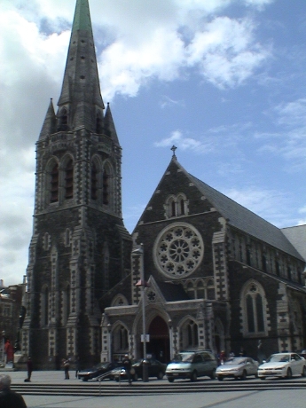 After the bus ride into the central city,
where this rather impressive cathedral is located, we also found a flea
market. It was probably there to support the passengers from the
Statendam which was indeed in port. We saw some of the ship's staff at
the flea market. I found a leather Kiwi hat to replace my 20 year old
Aussie leather hat which had died. I also found the gloves I was
looking for in a local shop. Almost all the gloves I had seen to date
had been New Zealand wool and they were pretty expensive. These were
polyester and Thinsulite and were only $15 NZ. They are quite warm and
comfortable and will live nicely in my jacket pocket. Sandy bought a
pair too to replace the ones that were in her lost jacket.
After the bus ride into the central city,
where this rather impressive cathedral is located, we also found a flea
market. It was probably there to support the passengers from the
Statendam which was indeed in port. We saw some of the ship's staff at
the flea market. I found a leather Kiwi hat to replace my 20 year old
Aussie leather hat which had died. I also found the gloves I was
looking for in a local shop. Almost all the gloves I had seen to date
had been New Zealand wool and they were pretty expensive. These were
polyester and Thinsulite and were only $15 NZ. They are quite warm and
comfortable and will live nicely in my jacket pocket. Sandy bought a
pair too to replace the ones that were in her lost jacket.
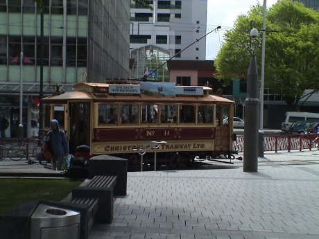 There is a trolly line that does a big loop
around the center city for $14 NZ. There is also a free shuttle bus
that runs a larger loop. However, we needed neither as we found what
were looking for just walking around the central square.
There is a trolly line that does a big loop
around the center city for $14 NZ. There is also a free shuttle bus
that runs a larger loop. However, we needed neither as we found what
were looking for just walking around the central square.
The temperature was running from very cold to quite warm and seeming to change every 15 minutes as the cloud deck formed and broke continuously. There wasn't a lot of wind and just the sunshine alone probably couldn't account for the rapid changes.
Our bus ticket had a free transfer so we used it to ride back to the hotel and then did our laundry. We'll probably watch videos on Sandy's computer or take a nap until dinner.
We just checked our email and my son found a site on the web that listed houses that had survived the fire. Mine is on the list. There is also a photo of part of the house. The only obvious problem is that a plastic no parking sign that I had posted the last time that I was there was melted and curled from heat. According to the report, virtually ALL of the houses on the other side of the street burned. We are still not out of the woods, we do not know how active the fire still is around the area. It is not at all clear when the fire got that close, but it was probably several days ago if somebody was allowed in to take photos today.
Since a large area around Green Valley Lake burned, this means that the power and telephone service to the whole area is probably burned out too. It'll be awhile before utilities can be re-established and the residents will be allowed back in.
 Today we got on yet another motor coach to travel
from Christchurch to Queenstown with a stop at Mt. Cook "along the
way." As we left Christchurch, we traveled through about 70 km of
totally flat farmland and then turned inland through another long
stretch of rolling farmland. Then we rounded a hill and a big stretch
of the Southern Alps rolled into view.
Today we got on yet another motor coach to travel
from Christchurch to Queenstown with a stop at Mt. Cook "along the
way." As we left Christchurch, we traveled through about 70 km of
totally flat farmland and then turned inland through another long
stretch of rolling farmland. Then we rounded a hill and a big stretch
of the Southern Alps rolled into view.
 We rode around a lake that had that light
blue color of glacial silt in it and Mt. Cook hove into view. This
photo was actually taken from much closer. The town of Mt. Cook is at
then end of a 55 km side trip from the main highway. The town sits at
the base of Mt. Cook itself. At the base of the mountain, the end of
the 23 km long Tasman Glacier is also in view. Mt. Cook is over 12,000
ft high and is the highest peak in this particular range. There is a
large hotel, several other hotels and more tourist attractions at the
town of Mt. Cook. We laid over there for almost 2 hours before heading
south again toward Queenstown.
We rode around a lake that had that light
blue color of glacial silt in it and Mt. Cook hove into view. This
photo was actually taken from much closer. The town of Mt. Cook is at
then end of a 55 km side trip from the main highway. The town sits at
the base of Mt. Cook itself. At the base of the mountain, the end of
the 23 km long Tasman Glacier is also in view. Mt. Cook is over 12,000
ft high and is the highest peak in this particular range. There is a
large hotel, several other hotels and more tourist attractions at the
town of Mt. Cook. We laid over there for almost 2 hours before heading
south again toward Queenstown.
 In
contrast to the Alpine environment of Mt. Cook, the land had many other
forms on the way south. This is Lindis pass, the highest point in this
stretch of road. It looks just like the area around Tejon Pass north of
LA. After passing into the next valley, we found another green valley
full of farms and vineyards.
In
contrast to the Alpine environment of Mt. Cook, the land had many other
forms on the way south. This is Lindis pass, the highest point in this
stretch of road. It looks just like the area around Tejon Pass north of
LA. After passing into the next valley, we found another green valley
full of farms and vineyards.
 Toward the
south end of that valley, fruit growing is the major activity and the
bus stopped at a fruit stand. For reference, this is a photo of the
typical Newmans motor coach. Newmans runs a "5 star" coach service with
large, comfortable coaches. The drivers provide commentary and the
busses make more rest stops than the "other" bus line, the InterCity
busses. However, InterCity is actually owned by the same company as
Newmans. Their busses are somewhat more cramped, there is no
commentary, fewer stops and no side trips to interesting locations.
These are the ones that the locals use to get from point A to point B.
The tourists usually get booked on Newmans.
Toward the
south end of that valley, fruit growing is the major activity and the
bus stopped at a fruit stand. For reference, this is a photo of the
typical Newmans motor coach. Newmans runs a "5 star" coach service with
large, comfortable coaches. The drivers provide commentary and the
busses make more rest stops than the "other" bus line, the InterCity
busses. However, InterCity is actually owned by the same company as
Newmans. Their busses are somewhat more cramped, there is no
commentary, fewer stops and no side trips to interesting locations.
These are the ones that the locals use to get from point A to point B.
The tourists usually get booked on Newmans.
We got to Queenstown in good order and we have a nice hotel room. We will be here for four nights. Tomorrow is a longish bus ride to Milford sound through some scenic territory, a cruise on Milford sound and a return bus ride on the same roundabout route back to Queenstown. The next two days are free.
One of the first things that we did when we got here was walk to a local market for some food. We've been eating out of markets instead of restaurants as formally served meals are pretty expensive and we'd been eating those meals for three weeks on the ship. We needed to cut back on the food. Virtually every market of any kind has a warm cabinet with meat pies. These are the size of a normal pot pie, but with a more substantial shell and some kind of meat and gravy filling. They are relatively inexpensive, cheap, probably fattening, and pretty good. One just doesn't find these kind of things in the US, they just never caught on there. The rest of my diet is fruit, granola bars, and DIY sandwiches.
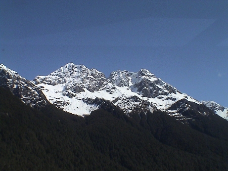 Today, we took an all day trip to Milford Sound
and the Southern Alps. Milford sound is probably less than 50 km from
Queenstown as the crow flies, but we drove 300 km of highway just to
get there. The road went south from Queenstown about 100 km along a
large lake and through a bunch of farmland, then turned roughly west
for another 80 km to the town of Te Anau. Then it was north again 120
km up through the Fjordland National Park up into the Alps.
Today, we took an all day trip to Milford Sound
and the Southern Alps. Milford sound is probably less than 50 km from
Queenstown as the crow flies, but we drove 300 km of highway just to
get there. The road went south from Queenstown about 100 km along a
large lake and through a bunch of farmland, then turned roughly west
for another 80 km to the town of Te Anau. Then it was north again 120
km up through the Fjordland National Park up into the Alps.
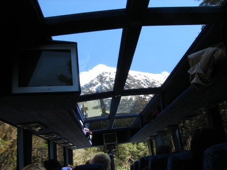 The bus was specially configured for this trip
with windows in the roof. Many of the peaks are so large and so close
that passengers not sitting at a window on that side have no hope of
seeing them. At least the roof windows give some idea of the size of
these mountains.
The bus was specially configured for this trip
with windows in the roof. Many of the peaks are so large and so close
that passengers not sitting at a window on that side have no hope of
seeing them. At least the roof windows give some idea of the size of
these mountains.
 One of the stops on the way was at a small
series of ponds called Mirror Lake. The water is usually so smooth that
a good reflection of the mountains are visible in the pond.
One of the stops on the way was at a small
series of ponds called Mirror Lake. The water is usually so smooth that
a good reflection of the mountains are visible in the pond.
 At
another stop, we came to an unremarkable looking stream, except that
the driver said that we could fill our water bottles from it. I was a
little skeptical until the other bus drivers (there were several there
at the time) were filling jugs. The water was really good and very
cold.
At
another stop, we came to an unremarkable looking stream, except that
the driver said that we could fill our water bottles from it. I was a
little skeptical until the other bus drivers (there were several there
at the time) were filling jugs. The water was really good and very
cold.
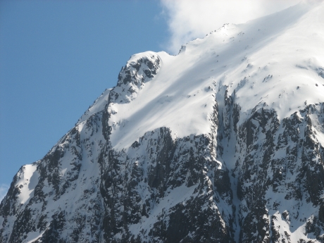 The road continued into a blind canyon with
sheer rock walls all around at least 1000 ft higher than the level of
the road. Neither of us got a good picture of either side through the
bus windows, but this is a peak near there. The bus then dove into a
1.2 km long tunnel and came out at the head of a hanging valley on the
other side. There were similar 1000+ ft sheer rock walls on this side
too. We then drove down a winding road toward the head of Milford
Sound, which isn't a sound at all, it's a fjord.
The road continued into a blind canyon with
sheer rock walls all around at least 1000 ft higher than the level of
the road. Neither of us got a good picture of either side through the
bus windows, but this is a peak near there. The bus then dove into a
1.2 km long tunnel and came out at the head of a hanging valley on the
other side. There were similar 1000+ ft sheer rock walls on this side
too. We then drove down a winding road toward the head of Milford
Sound, which isn't a sound at all, it's a fjord.
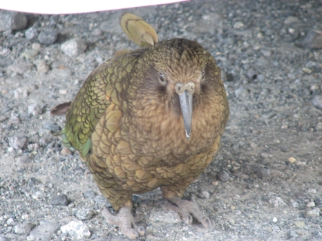 We stopped a place
called The Chasm that had a short walkway to a stream that was rushing
into and out of a chasm in the rocks. However, what I found interesting
was this Kea. It is a parrot that was thought to be extinct until some
were found in 1948. There are estimated to be only about 200 of these
birds in the wild but one of them was just sitting there under one of
the busses in the parking lot. It seemed unconcerned about a crowd of
tourists snapping pictures. These birds are the only parrot that lives
in an alpine environment and the only parrot that lives in New
Zealand.
We stopped a place
called The Chasm that had a short walkway to a stream that was rushing
into and out of a chasm in the rocks. However, what I found interesting
was this Kea. It is a parrot that was thought to be extinct until some
were found in 1948. There are estimated to be only about 200 of these
birds in the wild but one of them was just sitting there under one of
the busses in the parking lot. It seemed unconcerned about a crowd of
tourists snapping pictures. These birds are the only parrot that lives
in an alpine environment and the only parrot that lives in New
Zealand.
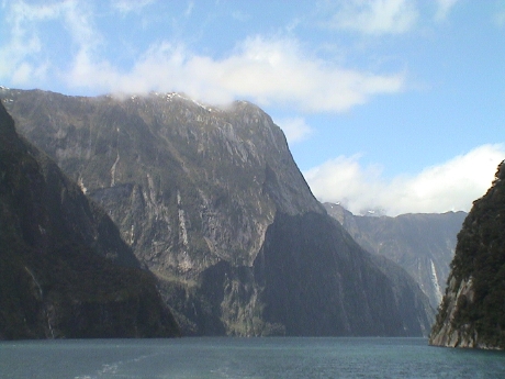 Milford Sound is pretty and has some impressive
features, but I thought that the trips through the Alps leading to the
sound was more impressive than the sound itself. The boat ride lasted
about 2 hours and took us out to the Tasman Sea. We understand that the
Statendam was due to cruise the sound later.
Milford Sound is pretty and has some impressive
features, but I thought that the trips through the Alps leading to the
sound was more impressive than the sound itself. The boat ride lasted
about 2 hours and took us out to the Tasman Sea. We understand that the
Statendam was due to cruise the sound later.
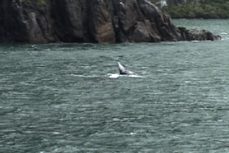 We did see a whale
in the sound. This is a very unusual occurrence here. This is a
southern right whale, a fairly small whale. It did show us some flukes
though.
We did see a whale
in the sound. This is a very unusual occurrence here. This is a
southern right whale, a fairly small whale. It did show us some flukes
though.
After the boat ride, it was another 4 hours on the bus to get back to Queenstown. It took longer to get out because we made many photo stops along the way. On the way back, we made only one stop back at Te Anau. Overall, it was a very long day. We are going to take it easy tomorrow, there is nothing on the schedule.
Today was a kick back and relax day. It was overcast but for the most part, quite comfortable. There were times when I removed my jacket. Yesterday it was clear and warm except on the boat where it was cold and windy. Today, there was no wind.
We've been traveling in New Zealand for over a week now and gathering information on this country from the TV, newspapers, bus drivers and our own observations. This is not a particularly rich country, but the kiwis get along quite well with what they have. The country is neatly kept and the New Zealanders obviously take some well deserved pride in their country. There is virtually no litter, little graffiti, and few eyesores around, at least in the areas that we have seen. This includes along rail lines in cities and towns, which in most countries, are among the ugliest areas. Crime seems to be a minor problem as compared to other countries, I feel more secure here that I feel at home. Even most drivers are very considerate of pedestrians, stopping to let us cross a road when they could just blast on by like they do in the US.
The economy here is strongly based in agriculture, particularly livestock. Most of the farmland is dedicated to pasture, relatively little to conventional crops. The largest agricultural export is dairy, followed by timber and sheep products. There are lots of vineyards, most seem to be dedicated to local consumption. Much of the cultivated land that is used for crops is for animal feed of some kind or other. The country, for the most part, relies on renewable energy, hydro, geothermal and wind. Motor fuel, however, is almost completely imported and is very expensive, running about $1.75 NZ/liter. There is little that we could find in the way of heavy manufacturing and mining, at least not on the scales of the US and Europe. This may be a good thing in a way, these industries tend to be the heaviest polluters and New Zealand is very ecologically "green." We have experienced zero air pollution, maybe due to the relatively small use of fossil fuels and certainly due to the wind which seems to blow everywhere, all the time.
Another significant economic segment is tourism. New Zealand seems to go a long way to make sure that tourists are well accommodated and that they can most efficiently extract as much money from each tourist as they can. At least it is easy to get around and find things to do. Our tour was mostly pre-booked as a package so we haven't had to do much in the way of arrangements, except for today and tomorrow which are "free."
This dependence on just a few crops and products for their major exports is well balanced and sustainable for now, but it can lead to major problems in the event of a upset. The dependence on a few high value agricultural products can produce good economic yields, but at a high risk. A serious bovine virus, for example, could seriously damage the dairy industry and lead to a real problem in balance of trade. A shift in the markets for the products produced here or some significant change in competition cold result in economic problems. Monocultures are generally not good when it comes to recoveries from disasters that can impact a single industry or crop.
In New Zealand, there is an organization called the MAF, or Ministry of Agriculture and Fisheries. These guys were all over the points of entry paying great attention to screening out plants, animals, insects and food items that may produce agricultural problems. Lots of plants and animals have been introduced into New Zealand in the last 150 years that have caused real problems. Possums were introduced from Australia for fur, but have seriously threatened native birds and consume lots of native plants. Rabbits can devastate the forage used for sheep and cows. Non-native plants can crowd out the native varieties. Deer and trout were introduced for sport. Deer were are still a major problem, the also eat the native vegetation and trample on the nesting grounds for native birds. However, deer are also farmed here for export because they are a low maintenance product. Trout have not seemed to harm much in the way of the environment and are still a big sportsman's draw and the do eat lots of bugs. Cows and sheep are introduced but tend not do well on their own so that they don't present a pest problem.
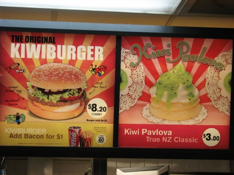 Today, we slept in late and then wandered
into town to see what was there and to look for activities for
tomorrow. We passed a McDonalds in our travels, the menu is slightly
different than in the US. We also passed through practically every gift
shop in the downtown area.
Today, we slept in late and then wandered
into town to see what was there and to look for activities for
tomorrow. We passed a McDonalds in our travels, the menu is slightly
different than in the US. We also passed through practically every gift
shop in the downtown area.
All over the country, there are "info" stations run by the government, I think. These basically act like neutral booking agents for the various attractions in the area. We booked a lake cruise on a 95 year old steamboat, the Earnslaw. This boat was originally operated by the New Zealand railways to extend the rail line from the south end of Lake Wakatipu at Kingston to Queenstown.
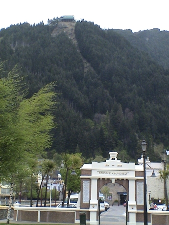 We also
bought a ticket for a gondola ride up the mountainside just north of
town, primarily for the view. The arch below is a monument to New
Zealanders that lost their lives in The Great War, 1914-1918.
We also
bought a ticket for a gondola ride up the mountainside just north of
town, primarily for the view. The arch below is a monument to New
Zealanders that lost their lives in The Great War, 1914-1918.
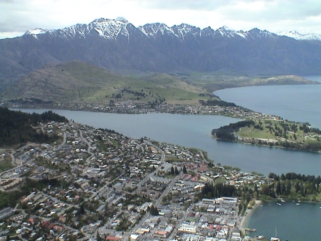 This is
central Queenstown as seen from the top of the gondola. There is a
tourist trap here with a cafe, a gift shop and a wheeled luge ride. The
view of the town is pretty good. Out hotel is situated a little below
and to the right of the center of the photo.
This is
central Queenstown as seen from the top of the gondola. There is a
tourist trap here with a cafe, a gift shop and a wheeled luge ride. The
view of the town is pretty good. Out hotel is situated a little below
and to the right of the center of the photo.
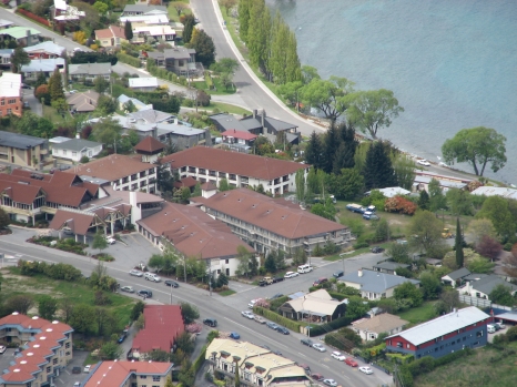 This is the Copthorne Lakefront Hotel as
seen from the top of the gondola. It is less than half a mile from the
center of town.
This is the Copthorne Lakefront Hotel as
seen from the top of the gondola. It is less than half a mile from the
center of town.
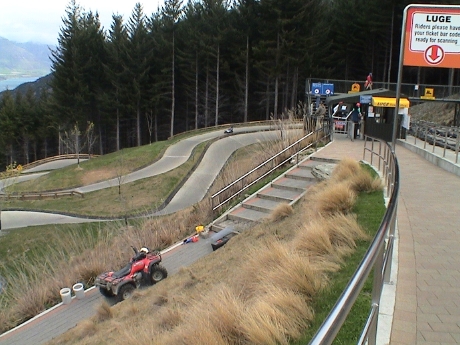 These luge rides are
all over New Zealand and I elected to try it out. It's and 800 m
concrete track on which riders take fairly high speed ride down hill.
The luge sleds are very stable, have good brakes and turn well due to a
very low center of gravity.
These luge rides are
all over New Zealand and I elected to try it out. It's and 800 m
concrete track on which riders take fairly high speed ride down hill.
The luge sleds are very stable, have good brakes and turn well due to a
very low center of gravity.
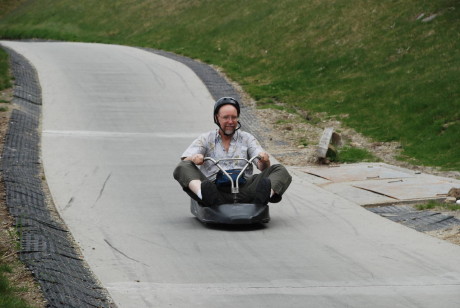 I rode
the luge twice. The first time was down the "scenic" track because they
insist that the first ride of the day is on the easier track. Then I
came down the "expert" track which was considerably more interesting.
The ride was fun, but didn't last long enough to be really worth
$8/shot.
I rode
the luge twice. The first time was down the "scenic" track because they
insist that the first ride of the day is on the easier track. Then I
came down the "expert" track which was considerably more interesting.
The ride was fun, but didn't last long enough to be really worth
$8/shot.
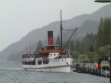 Today, we had booked the noon sailing of the T.S.S.
Earnslaw, a steamship built in 1912 to run on this lake. It originally
extended the rail line from the southern tip of the lake to the other
towns on Lake Wakatipu. It ran until about the 30's when car and truck
traffic on new roads laid next to the lake made it economically
ineffective. It then was used to haul livestock for a while before
being beached and abandoned. It was resurrected as a tourist attraction
including all it's original equipment. A diesel generator set was added
for electric power, but all the ship's machinery still runs on steam.
The ship is 160 ft long, 24 ft wide and displaces 340 tons.
Today, we had booked the noon sailing of the T.S.S.
Earnslaw, a steamship built in 1912 to run on this lake. It originally
extended the rail line from the southern tip of the lake to the other
towns on Lake Wakatipu. It ran until about the 30's when car and truck
traffic on new roads laid next to the lake made it economically
ineffective. It then was used to haul livestock for a while before
being beached and abandoned. It was resurrected as a tourist attraction
including all it's original equipment. A diesel generator set was added
for electric power, but all the ship's machinery still runs on steam.
The ship is 160 ft long, 24 ft wide and displaces 340 tons.
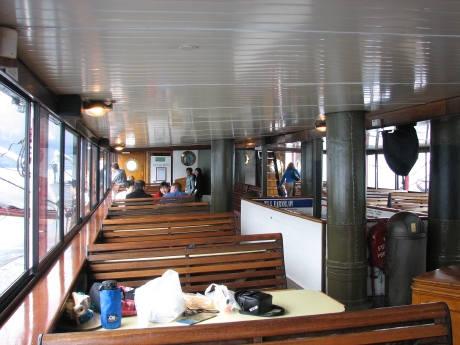 There are two passenger decks, this is the
upper deck. Our stuff is spread out on the nearest table. The white
area to the right is an opening looking down into the engine room. It
is also possible to walk through the engine room on the next deck
down.
There are two passenger decks, this is the
upper deck. Our stuff is spread out on the nearest table. The white
area to the right is an opening looking down into the engine room. It
is also possible to walk through the engine room on the next deck
down.
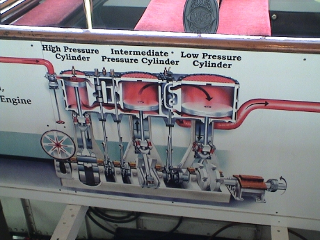 This
really is a steamship. There are two double acting, triple expansion
steam engines that make a total of 500 hp and will drive the ship to 12
or 13 knots. The sign is painted in the inside of the opening looking
down to the engines.
This
really is a steamship. There are two double acting, triple expansion
steam engines that make a total of 500 hp and will drive the ship to 12
or 13 knots. The sign is painted in the inside of the opening looking
down to the engines.
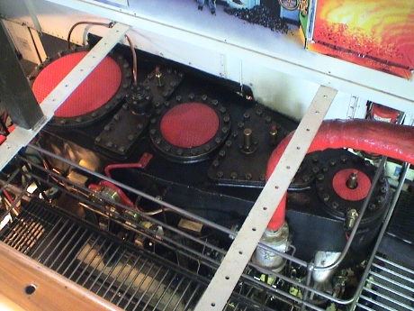 These is one of the actual engines. There are
three cylinders, the steam is expanded three times, once in each
cylinder. Since the exhaust from the first cylinder is at lower
temperature and pressure than when it entered, it takes up more volume.
The second cylinder is therefore larger to accommodate the larger
volume. The third is larger yet. All three and connected to the same
crankshaft which drives one propellor. There is an identical engine on
the other side of the ship.
These is one of the actual engines. There are
three cylinders, the steam is expanded three times, once in each
cylinder. Since the exhaust from the first cylinder is at lower
temperature and pressure than when it entered, it takes up more volume.
The second cylinder is therefore larger to accommodate the larger
volume. The third is larger yet. All three and connected to the same
crankshaft which drives one propellor. There is an identical engine on
the other side of the ship.
A smaller steam engine runs a condenser that reduces the temperature of the exhaust such that it completely condenses and maintains the vacuum for the 3rd stage of the engine. A separate steam powered pump injects lake water into the boilers.
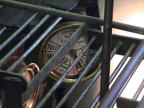 The ship
still uses a standard mechanical telegraph from the bridge. This is the
way that the captain signals to the engineer the speed and direction
that he wants for each engine. There are two telegraphs. Every time it
is moved, it rings a bell, the port and starboard telegraphs have bells
of different tones. The ship has three speeds in each direction, Full,
Half and Slow. There are also positions on the telegraph for Standby,
Stop, and Done with Engines. The engineer reads the telegraph
indicators to determine how to set the steam valve and engine valve
timing to set the direction that the engine runs.
The ship
still uses a standard mechanical telegraph from the bridge. This is the
way that the captain signals to the engineer the speed and direction
that he wants for each engine. There are two telegraphs. Every time it
is moved, it rings a bell, the port and starboard telegraphs have bells
of different tones. The ship has three speeds in each direction, Full,
Half and Slow. There are also positions on the telegraph for Standby,
Stop, and Done with Engines. The engineer reads the telegraph
indicators to determine how to set the steam valve and engine valve
timing to set the direction that the engine runs.
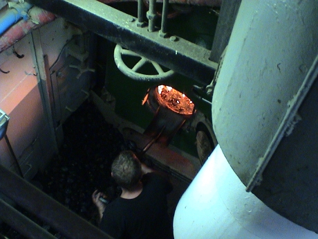 Although not very visible in the last photo, there
are two steam pressure gauges, one for each boiler/engine combination.
The stoker will shovel coal based on the engine speed and anticipated
load to keep the steam pressure as close to 160 psi as he can. Both
boilers are locomotive fire tube types and are completely hand stoked.
The boilers consume 1 ton of coal an hour. The ship holds 14 tons.
Although not very visible in the last photo, there
are two steam pressure gauges, one for each boiler/engine combination.
The stoker will shovel coal based on the engine speed and anticipated
load to keep the steam pressure as close to 160 psi as he can. Both
boilers are locomotive fire tube types and are completely hand stoked.
The boilers consume 1 ton of coal an hour. The ship holds 14 tons.
Coal is loaded twice a day, once into the port bunker and once into the starboard bunker. As the coal is loaded, the ship may become unbalanced so that a large chunk of concrete sits on the foredeck. It is shifted left or right with a steam powered crane to trim the ship as necessary.
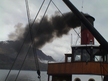 When the stoker piles on the coal, he also
disturbs the flame bed and the ship will smoke profusely. Most of the
time, it doesn't smoke as much.
When the stoker piles on the coal, he also
disturbs the flame bed and the ship will smoke profusely. Most of the
time, it doesn't smoke as much.
We went out for pizza this evening at Pizza Hut. A "large" was $11.90 but it is what I would call "medium" in the US. When I was paying for it, I finally realized that the smallest coin that I had seen, and the smallest on in the cash box, was $0.10. Many prices in NZ are listed as $X.YY but you can't pay in pennies except by charge card. I assume that they use a rounding rule instead of just rounding up all the time, but I am not sure. Currently $1 US = $1.21 NZ.
Tomorrow, we board another bus for a trip up the west coast to Franz Joseph where there is a large glacier. We will stay there one night and then get on another bus to Greymouth to board the Tranz Alpine train back to Christchurch.
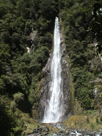 The bus ride north was partially on the same
road that we used to get to Queenstown. However, about a third of the
way up, it split toward the west coast. On the way, we stopped at a
waterfall for a photo opportunity and a chance to stretch our legs.
The bus ride north was partially on the same
road that we used to get to Queenstown. However, about a third of the
way up, it split toward the west coast. On the way, we stopped at a
waterfall for a photo opportunity and a chance to stretch our legs.
The busses often stop at overlooks, cafe's or other rest stops. If they didn't, the passengers would start to get cranky. I'm sure that the cafe's are picked because they give the drivers a free lunch or something in return for bringing in a busload of money into their shop. Anyway, these places are set up to deal with several busloads of passengers at one time.
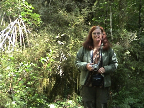 This area is mostly natural forest, unlike much
of the rest of the island where the forests have all be cut down for
farmland or replanted in neat rows for timber growth after being logged
once.
This area is mostly natural forest, unlike much
of the rest of the island where the forests have all be cut down for
farmland or replanted in neat rows for timber growth after being logged
once.
 The west coast is clearly not a densely populated
area. It was either undeveloped, or rough pastures. There were few
sheep, some horses and beef. Services are few and far between as well.
The few towns that were there were very small. We stopped at one stop
to pick somebody up and I saw this truck out of the front of the bus.
There isn't a sufficient population density to support a butcher shop
so that they have a mobile butcher.
The west coast is clearly not a densely populated
area. It was either undeveloped, or rough pastures. There were few
sheep, some horses and beef. Services are few and far between as well.
The few towns that were there were very small. We stopped at one stop
to pick somebody up and I saw this truck out of the front of the bus.
There isn't a sufficient population density to support a butcher shop
so that they have a mobile butcher.
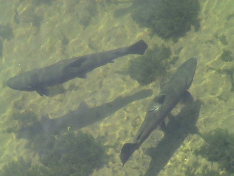 About
1400, we stopped at yet another cafe, this one is a trout and salmon
farm as well. These fish are about 2 ft long. The driver said that the
salmon was very good, but at $30 we decided to pass. Besides, I had
eaten at about 1100 at an earlier stop and I wasn't even a little bit
hungry. There, we both ate for about $15, including the ice cream
cones.
About
1400, we stopped at yet another cafe, this one is a trout and salmon
farm as well. These fish are about 2 ft long. The driver said that the
salmon was very good, but at $30 we decided to pass. Besides, I had
eaten at about 1100 at an earlier stop and I wasn't even a little bit
hungry. There, we both ate for about $15, including the ice cream
cones.
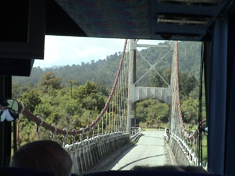 Since we left Christchurch, we've been finding
one lane bridges all over the place. When the roads were put into these
areas, often after 1950, there wasn't much traffic and a one lane
bridge is a lot cheaper to build than a two lane one. We've crossed
maybe a hundred of the things so far, some so narrow that I was
surprised that the bus actually fit. Even now, we've never had to wait
at one for opposing traffic. Most of them aren't suspension bridges
like this one, but the one over the Haast river where it drains to the
Tasman Sea is a half a mile long.
Since we left Christchurch, we've been finding
one lane bridges all over the place. When the roads were put into these
areas, often after 1950, there wasn't much traffic and a one lane
bridge is a lot cheaper to build than a two lane one. We've crossed
maybe a hundred of the things so far, some so narrow that I was
surprised that the bus actually fit. Even now, we've never had to wait
at one for opposing traffic. Most of them aren't suspension bridges
like this one, but the one over the Haast river where it drains to the
Tasman Sea is a half a mile long.
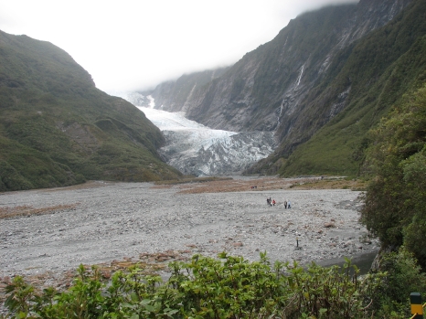 Franz Josef primarily exists to serve tourists
visiting the Franz Josef Glacier. This is kind of an odd glacier as it
is nearly at sea level in a sub tropical zone. It sits only a few
kilometers from the coast in a sub tropical forest. The fact that it
exists at all is because of the rapid rise of the southern Alps. Moist
air blowing in from the Tasman Sea is uplifted rapidly and dumps a lot
of rain in the area, 3 meters a year at the coast, 5 meters a year at
the base of the glacier and 20 to 50 meters of snow a year in the
glacier field. This large input of snow is why it can continue to exist
in an area that isn't all that cold. The glacier is currently advancing
at about 1 meter a day. 150 years ago, it filled most of this valley.
30 years ago, it could hardly be seen from this point.
Franz Josef primarily exists to serve tourists
visiting the Franz Josef Glacier. This is kind of an odd glacier as it
is nearly at sea level in a sub tropical zone. It sits only a few
kilometers from the coast in a sub tropical forest. The fact that it
exists at all is because of the rapid rise of the southern Alps. Moist
air blowing in from the Tasman Sea is uplifted rapidly and dumps a lot
of rain in the area, 3 meters a year at the coast, 5 meters a year at
the base of the glacier and 20 to 50 meters of snow a year in the
glacier field. This large input of snow is why it can continue to exist
in an area that isn't all that cold. The glacier is currently advancing
at about 1 meter a day. 150 years ago, it filled most of this valley.
30 years ago, it could hardly be seen from this point.
The approach to the glacier was via a trail cut through the forest. When we got to the end of the trail, we were faced with a cross country hike through a river bed. The glacier is at least 2 km away at this point but the walk didn't look too bad.... until we got out there.
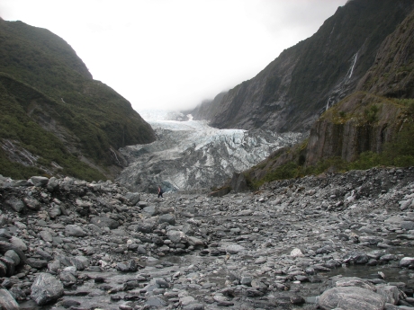 After fording a couple of streams by jumping
from rock to rock and working around rocks the whole way, this is a far
as we got. We had a two hour window so that we could make it back to
the last shuttle bus to town and we were almost halfway through the
window. The way ahead wasn't looking too good either. Further, we
wouldn't be allowed to get closer than 500 m from the glacier anyway
for safety reasons.
After fording a couple of streams by jumping
from rock to rock and working around rocks the whole way, this is a far
as we got. We had a two hour window so that we could make it back to
the last shuttle bus to town and we were almost halfway through the
window. The way ahead wasn't looking too good either. Further, we
wouldn't be allowed to get closer than 500 m from the glacier anyway
for safety reasons.
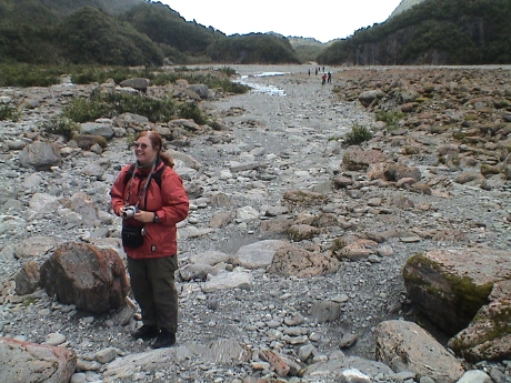 The way back was not looking as bad as the way
forward so we turned around there. We actually made better time on the
way back, our total walking time was 90 minutes. I figure that we did
about 4 miles round trip.
The way back was not looking as bad as the way
forward so we turned around there. We actually made better time on the
way back, our total walking time was 90 minutes. I figure that we did
about 4 miles round trip.
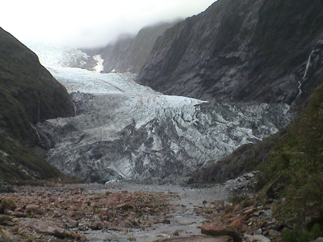 This is a closeup of the glacier from our
closest approach. Remember that it is probably still about 1 km
away.
This is a closeup of the glacier from our
closest approach. Remember that it is probably still about 1 km
away.
After the shuttle ride back to town, we stopped by a grocery store to buy dinner materials. We ate and Sandy promptly crashed.
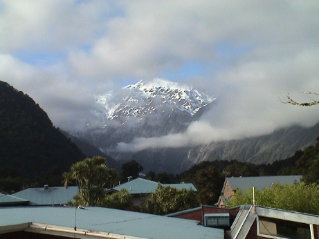 We didn't have enough time in Franz Josef. It
would have been better if we'd stayed a whole day and took one of the
guided trips to the glacier. Then we could have had the time to
actually get all the way to it and actually climbed on it. However, our
schedule didn't allow that. We needed to be on a bus the next
morning.
We didn't have enough time in Franz Josef. It
would have been better if we'd stayed a whole day and took one of the
guided trips to the glacier. Then we could have had the time to
actually get all the way to it and actually climbed on it. However, our
schedule didn't allow that. We needed to be on a bus the next
morning.
When morning did arrive, the clouds had parted, at least mostly parted, around one of the mountains next to the glacier. This is the view from our hotel window. Then we packed and got on a bus.
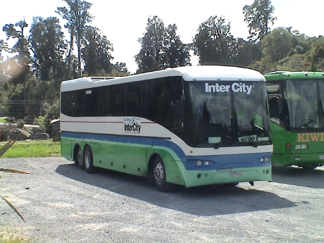 This time, we rode on an Intercity bus. These are
run by the same company as Newmans, but it is a lower grade bus. It
didn't have the computer controlled automatic leveling and air shocks
to control the bumps so that the ride was a lot rougher. The seats
seemed closer together as well.
This time, we rode on an Intercity bus. These are
run by the same company as Newmans, but it is a lower grade bus. It
didn't have the computer controlled automatic leveling and air shocks
to control the bumps so that the ride was a lot rougher. The seats
seemed closer together as well.
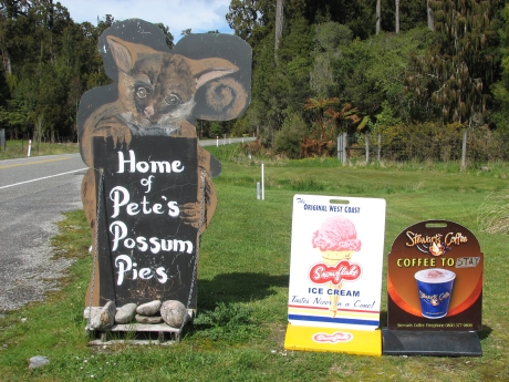 The bus didn't leave the hotel until after 0900
and after only an hour or so, we stopped at a cafe of sorts for
breakfast. This was Pete's Place, the most "rustic" cafe we'd been to.
Pete's speciality is possum pies. I wasn't hungry and even if I was, I
probably would not have tried one.
The bus didn't leave the hotel until after 0900
and after only an hour or so, we stopped at a cafe of sorts for
breakfast. This was Pete's Place, the most "rustic" cafe we'd been to.
Pete's speciality is possum pies. I wasn't hungry and even if I was, I
probably would not have tried one.
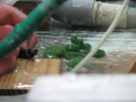 We traveled north for only an hour or so to our
next stop for lunch in the town of Hokitika. This place had several
jade shops as it seems to be the center of jade jewelry production.
This is a carver at work making Maori style ornaments. This time we
were a little hungry. We found a fish and chips shop that was
reasonably priced and I had a large piece of fish for $2.70 and Sandy
got an ice cream cone. We had planned to eat our picnic lunch on the
train anyway.
We traveled north for only an hour or so to our
next stop for lunch in the town of Hokitika. This place had several
jade shops as it seems to be the center of jade jewelry production.
This is a carver at work making Maori style ornaments. This time we
were a little hungry. We found a fish and chips shop that was
reasonably priced and I had a large piece of fish for $2.70 and Sandy
got an ice cream cone. We had planned to eat our picnic lunch on the
train anyway.
The bus ride ended at Greymouth, the western terminus of the Tranz Alpine train. We got on the train and instead of eating the planned picnic lunch, we got meat pies at the cafe car. The picnic lunch was delayed until dinner.
The train pulled out of Greymouth and headed up a river valley going generally south east. I was out in the open observation car when a train attendant came out and chased us all back into the train. It seems that we were about to enter an 8.5 km long tunnel and the diesel exhaust in the tunnel would have been bad. They wanted to close up the train before we entered the tunnel, which was a good thing.
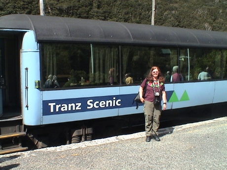 Right at the other end of the tunnel was
Arthur's Pass station. The train stopped there and they let us off the
train for a few minutes to take pictures and stretch. Arthur's Pass is
the highest point on the line at 737 m.
Right at the other end of the tunnel was
Arthur's Pass station. The train stopped there and they let us off the
train for a few minutes to take pictures and stretch. Arthur's Pass is
the highest point on the line at 737 m.
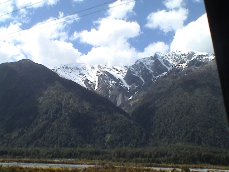 This is the typical southern alps mountain as
seen from the train as we descended down a river valley on the other
side. However, as soon as they announced that the best scenic part of
the ride was coming up, the observation car, which wasn't very big,
filled up and it was impossible to find a place to frame a good
photo.
This is the typical southern alps mountain as
seen from the train as we descended down a river valley on the other
side. However, as soon as they announced that the best scenic part of
the ride was coming up, the observation car, which wasn't very big,
filled up and it was impossible to find a place to frame a good
photo.
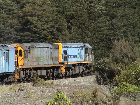 Being a
train buff, I did manage to photograph the train's engines as we
rounded a curve. We were double headed with 6 axle diesel engines.
These are narrow gauge engines, yet are the size of a conventional US
road switcher like an SD9.
Being a
train buff, I did manage to photograph the train's engines as we
rounded a curve. We were double headed with 6 axle diesel engines.
These are narrow gauge engines, yet are the size of a conventional US
road switcher like an SD9.
We finally descended the river valley onto the Canterbury plain and traveled through flat farmland for about 2 hours into Christchurch. It's one night in a hotel and then back on the train at 0700 for the ride back up to Picton and the ferry to Wellington where we'll stay the night.
We're a little over half the way between Christchurch and Picton on the Tranz Coastal train. It is not particularly easy typing on a laptop computer on a lurching train.
A little while ago, we got a cell phone call from our son, Charlie. The evacuation order for Green Valley Lake was lifted and he drove up there to see what had happened, which was a lot. The fire was very serious. My house survived, but it was probably the next to burn. All the houses on the other side of the street, those abutting the National Forest, are gone. All the houses on my side of the street and uphill from mine are gone. Some houses in other locations were burned by spot fires. Some of the buildings in the village were burned. A lot of people lost their homes to this fire.
 This
is a map of the fire history for this area going back only 10 years. We
were on vacation at Bishop Creek when the Willow fire burned the area
north. A few years later, the Old fire burned up from the south and was
enclosing Green Valley Lake on two sides until a snowstorm put out the
fire. A few months ago, the Butler 2 fire (yellow) burned to within a
couple of miles from the valley. Then the Slide fire (pink) started at
the edge of the Butler 2 fire burn area and the Santa Ana winds took it
right around Green Valley and then in from the edges. Green Valley Lake
is the cluster of roads right in the middle of the Slide fire burn
area. It then burned down through Running Springs. I expect that much
of the forest visible from my house is burned too. This area was full
of very large trees and old growth. It was logged about a hundred years
ago but there has been plenty of time for forest regrowth.
This
is a map of the fire history for this area going back only 10 years. We
were on vacation at Bishop Creek when the Willow fire burned the area
north. A few years later, the Old fire burned up from the south and was
enclosing Green Valley Lake on two sides until a snowstorm put out the
fire. A few months ago, the Butler 2 fire (yellow) burned to within a
couple of miles from the valley. Then the Slide fire (pink) started at
the edge of the Butler 2 fire burn area and the Santa Ana winds took it
right around Green Valley and then in from the edges. Green Valley Lake
is the cluster of roads right in the middle of the Slide fire burn
area. It then burned down through Running Springs. I expect that much
of the forest visible from my house is burned too. This area was full
of very large trees and old growth. It was logged about a hundred years
ago but there has been plenty of time for forest regrowth.
The train was about 20 minutes late getting into Picton, but we had little difficulty getting from the train to the ferry with a half hour to spare. I did have to straighten out a problem with our tickets, we never got confirmation or a voucher. However, both the railroad and the ferry line had us on file as paid so that it was no real problem. The ferry ride was uneventful. We collected our luggage at the ferry terminal and caught a free shuttle to the train station.
Our hotel is a block from the station. We also found a market in the station so that after we checked in we went back and bought some food. The room has a kitchenette with a microwave so we were able to buy some frozen stuff to cook and food to make lunch and dinner tomorrow.
Wellington was cold and dreary when we got in and by the time that we left the market in the train station, it was raining. Welcome to Wellington.
The train north to Auckland leaves at 0725 tomorrow morning so it will be another early start. We had planned one day of margin into our schedule and it looks like we won't need it so we'll have a free day in Auckland before we head to the airport for a 23 hour series of flights (Auckland, Sidney, Honolulu, Lihu'e) to Kaua'i. There, we have a 2 bedroom condo booked. We'll meet Sandy's father, Charlie, at the Lihu'e airport a few hours after we get in for a week of R&R. Then we fly back to LAX via Oakland.
There is a coffee shop next to the hotel that has free internet with any purchase so we are going to go down there and rent a table for awhile.
We're currently sitting on a broken train somewhere north of the halfway point on our trip from Wellington to Auckland. The engine failed and they are sending back another one to rescue us. Since the train isn't moving, I figured that it would be a good time to catch up on this trip diary.
This morning, Wellington was cold, dreary and wet. We got up at 0600 to make the train, the stating was less than 5 minutes walk away. We got checked in without difficulty and got on the last car of the train. Right on time at 0725 the train pulled out. This was the last time that we were on time. We stopped many times for track work, usually only for a couple of minutes, but it added up.
The rail system in and around Wellington is electrified at 1200 VDC to support the commuter trains that run out to about 50 km from Wellington. However, our train had a diesel on the point. We needed the diesel engine because the wire ran out at Paekakariki. We picked up the wire again at Palmerston North, another 87 km north. However, this time the wire has 25 kV AC on it. Lower voltage DC is better for the light haul commuter type trains but doesn't do so well for the long haul. The higher voltage covers distance better but it requires heavier and bulkier equipment on the engine, not an ideal situation for commuter cars. The engine on our train would normally be switched to an electric loco at Palmerston North, but our train retained the diesel loco.
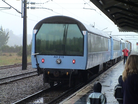 It was raining most of the way from Wellington so
that visibility from the train was quite limited. There wasn't much to
see anyway, most of the area is covered with sheep farms. There were
sheep everywhere. The major stop roughly in the middle of the line is
at National Park which encloses the two large volcanos in the center of
the north island. They were not visible due to the clouds and rain.
This is a photo of our coach on the Overlander train. There is a lounge
area right inside the large rear window.
It was raining most of the way from Wellington so
that visibility from the train was quite limited. There wasn't much to
see anyway, most of the area is covered with sheep farms. There were
sheep everywhere. The major stop roughly in the middle of the line is
at National Park which encloses the two large volcanos in the center of
the north island. They were not visible due to the clouds and rain.
This is a photo of our coach on the Overlander train. There is a lounge
area right inside the large rear window.
The train crews switched there with the crew on our train switching with the southbound train so that the crews could head home. There I asked one of the crew members and he said that the New Zealand railways are 3'6" gauge. I thought that the track looked a little bit wide for 3' narrow gauge.
Just out of National Park, the track does a one turn spiral, somewhat like the Tehachapi Loop, to descend a particularly difficult grade. It wasn't long after that that the engine died.
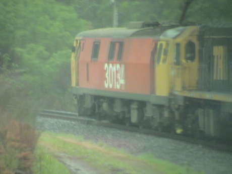 After about an hour wait, the electric rescue
engine arrived and hooked up and we got on our way again but about 2
hours behind schedule. Sorry about the quality of the photo but I was
shooting through a train window covered with raindrops.
After about an hour wait, the electric rescue
engine arrived and hooked up and we got on our way again but about 2
hours behind schedule. Sorry about the quality of the photo but I was
shooting through a train window covered with raindrops.
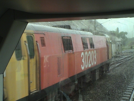 The reason that a spare engine got to us out in
the boonies so quickly is that a double headed freight was sitting on a
siding at the bottom of the hill waiting for us to pass. They unhooked
the lead engine and sent it uphill to pull us down. When we got back to
the siding we stopped to let the freight driver get back on his, now
single headed, train and continue. Our driver took over the electric
and off we went. The freight wasn't that long and a single electric
would be enough for it to get back over the grade.
The reason that a spare engine got to us out in
the boonies so quickly is that a double headed freight was sitting on a
siding at the bottom of the hill waiting for us to pass. They unhooked
the lead engine and sent it uphill to pull us down. When we got back to
the siding we stopped to let the freight driver get back on his, now
single headed, train and continue. Our driver took over the electric
and off we went. The freight wasn't that long and a single electric
would be enough for it to get back over the grade.
With the electric on the point, we've been able to maintain our 2 hour delay. It'll be a 14 hour train ride by the time we are done. Fortunately our hotel in Auckland is only a couple of blocks from the train station.
Today is our margin and rest day before the 23 hour series of airplane flights. In Wellington, we booked a room for last night at the Hyatt in Auckland but we still needed one more room. The original plan was to travel over to the airport to book another hotel, but instead we elected to stay in town to rest and take a cab over in the morning. The Hyatt was booked full for tonight and so was the Copthorne Anzac where we stayed our first day here. I booked a room at The Quadrant right next door to the Hyatt so we had to move. It's raining in Auckland but the move next door was only a minor hassle, we didn't get too wet.
Our flight tomorrow is at 0900 so we have to leave the hotel by 0600 to allow some margin. We will probably have an internet and cell phone blackout for most of the trip. We have a very long layover in Sydney but we will probably be stuck in a transit lounge the whole time.
The room in the Hyatt was clearly the nicest room that we've had to date. All the rest have been ordinary hotel rooms, but we got put into a suite at a single room rate. It's too bad that we couldn't have kept that room. The one in the Quadrant is still two rooms and it is smaller, but still quite nice. This one has a kitchenette.
This is way that I think that our agenda will work out for Hawai'i.
| Day | Date | Location | Travel Method | Notes |
|---|---|---|---|---|
| 43 thru 50 | 7 Nov 07 thru 14 Nov 07 | Kaua'i, Hawai'i | rental car | Spend a week |
| 51 | 15 Nov 07 | Lihu'e Oakland Los Angeles |
air | the return flights via Oakland were less expensive than a flight directly back to LAX, go figure. Our flights actually start at 2300 on Nov 14 |
About noon we headed out to visit the central shopping district of Auckland on Queen Street. The place was packed with people, mostly young, walking up and down the street. On Queen Street, most of the traffic lights are timed with a pedestrian walk signal all around at the same time so that foot traffic flows diagonally across the intersections as well as in the crosswalks. We went as far as the Maritime Museum on the wharf and then headed back stopping for some food for dinner and snacks for the flight tomorrow.
We're stuck in the terminal at Sydney waiting through an 8 hour layover for our flight to Honolulu. We're all checked in, we just have to wait. We don't even know what part of the terminal that the flight will leave from, it's just too early. I used much of our remaining New Zealand currency to buy lunch in the terminal. There is wireless internet access here provided by two ISPs, but I couldn't even connect to one of them and the other one was too expensive to actually use. Further, there are three free internet terminals down the hall from the lounge we are in. We've camped next to a power outlet to recharge all our goodies from the flight over from Auckland.
This is going to be a long day. We got up at 0500 to make a flight at 0900 NZ time. On the flight back to Honolulu, we recross the International Date Line. We arrive at Lihu'e at 0930 on the same day that we left. By date, the whole trip takes 30 minutes with the elapsed time being 24.5 hours from flight departure to flight arrival. Since I counted days by our frame of reference, I will continue to count days the same way on the way back. On the way out, Oct 11 simply did not exist. On the way back, Nov 6 counts as two days.
It's a new day but the same date. This entry is also time stamped BEFORE the last one as we've crossed back over the International Date Line. The flight from Sydney was uneventful but long. I hardly slept at all. We did have a snafu with our boarding passes because the airplane that we checked in on wasn't the same one we went out on. It was supposed to be a JetStar aircraft but it had some kind of problem and a Qantas plane was substituted and the seat numbers didn't add up so the machine rejected our boarding passes.
When we arrived in Honolulu, we went through the standard immigration, customs and TSA hassles but we are sitting at gate 61 waiting for our flight to Lihu'e.
The flight to Lihu'e was about a half hour late, but we got there. However, it was about 1100 when we got to the Pono Kai Resort and check in wasn't until 1600. We had 5 hours to burn.
The Pono Kai is basically a timeshare thing situated in Kapa'a about 5 miles north of Lihu'e which is the largest town on the island and the location of the airport. There are lots of resorts here, but not many traditional hotels and motels. There also isn't the extreme concentration of tourist services other than the resorts themselves. There is still lots of stuff here, it just isn't as intense as other places we have been. The island seems a lot more laid back than some of the other places in Hawai'i.
The resort had a guest room which was basically a small shared apartment where folks that hadn't checked in yet, or had already checked out, could hang out until the could go somewhere else. I needed a shower and a change of clothes big time so I took care of that almost immediately. Then we drove around looking to see how common internet access was. The answer is that the concept of an internet cafe here is pretty foreign. We found one about a quarter mile up the street with "free" wireless, probably after you bought something in the coffee shop. We found another far away in Lihu'e that wanted $10/hr. The terminal in the reception area was $0.30/min. Later I found that the in room wired internet is $40/week. I'll probably just pony up for that as I had been spending $3 to $6 a day to feed my internet habit in little bits and pieces anyway all along on this trip. The $40/week option is all you can eat from a cable modem.
In our wanderings, we started to get a feel of the lay of the land around Kapa'a and Lihu'e. We found the Costco, a K-Mart and a couple of large grocery stores. Since gas is about $3.50/gal at the regular stations, it would seem reasonable to fill up the rental car at Costco.
We rented a "small" car. It is some sort of 4 door Dodge with a hatchback. It is big enough, but the engine is not. It's pretty hurting for acceleration. We rolled back to the resort about 1400 and our room was actually ready so we moved in.
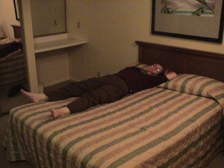 Sandy was pretty tired after all the travel
and she just melted. It's pretty hot here, about 90°F, and very
humid. This is in stark contrast to New Zealand were we considered
ourselves fortunate for weather in the high 60's. There are two air
conditioner units in the unit, both have been running full time since
we got here and it still hasn't really cooled down upstairs. The living
room is fairly cool now, in the high 70's. but the downstairs bedroom
is still pretty warm.
Sandy was pretty tired after all the travel
and she just melted. It's pretty hot here, about 90°F, and very
humid. This is in stark contrast to New Zealand were we considered
ourselves fortunate for weather in the high 60's. There are two air
conditioner units in the unit, both have been running full time since
we got here and it still hasn't really cooled down upstairs. The living
room is fairly cool now, in the high 70's. but the downstairs bedroom
is still pretty warm.
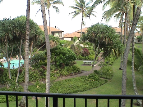 This is the view from our 3rd story balcony,
it looks pretty much like a typical resort.The condo is a two story
affair with a loft upstairs and a bedroom, living room, bathroom and
kitchen downstairs. The refrigerator has an icemaker, but so far, it
hasn't come even close to keeping up with my ice consumption.
This is the view from our 3rd story balcony,
it looks pretty much like a typical resort.The condo is a two story
affair with a loft upstairs and a bedroom, living room, bathroom and
kitchen downstairs. The refrigerator has an icemaker, but so far, it
hasn't come even close to keeping up with my ice consumption.
We picked up Charlie, Sandy's father, at the airport. He will be staying with us this week. After a few minutes of acclimation, we walked a couple of blocks to a restaurant for dinner. I got some pretty good fish tacos. We stopped across the street at an ABC Store (the Hawaiian equivalent to a 7-11) and got some stuff for breakfast. Then it was a quick walk back to the condo for bed. I plan to sleep in tomorrow.
We have only three things on the agenda for a whole week, we ought to be able to fit them in. We are going to drive the island perimeter road each direction until it ends, one day trip each direction. Sandy is also going to book a luau because Charlie has never been to one. Sounds like a full enough agenda to me.
At 0600 by my internal clock told me it was time to get up so I got up. The refrigerator has finally stabilized cold enough to get drinks cold and the ice machine production has increased. Now the cubes are cold enough to last more than two minutes and there are lots of them. The air conditioner is STILL running full time. It got too cold in the living room but it's nice upstairs so I set the thermostat up a little. It'll take a couple of days to get this place tuned up.
We got a call from the concierge at 0800 reminding us to pick up our "welcome packet." I got a good map of snorkel locations but the rest of it was useless, just minor discounts to overpriced restaurants.
For today, we elected to drive the south side of the island to Wiamea Canyon and back with a stop at Costco on the way back for provisions and mini-DV tapes.
We drove mostly directly to Wiamea Canyon, about 40 miles. Wiamea Canyon is called the little grand canyon because it resembles the real thing in miniature. As we approached the southwest part of Kaua'i, the vegetation got more sparse and more brown. It started looking like parts of California. At the town of Wiamea, we turned off Hwy 50 onto Hwy 550 and turned north to go up the west side of the canyon.
 After about 10 miles of twisty roads we got
to the main lookout point at Wiamea Canyon. This is sort of a "we wuz
there" kind of a photo that some other tourist snapped for us on my
camera.
After about 10 miles of twisty roads we got
to the main lookout point at Wiamea Canyon. This is sort of a "we wuz
there" kind of a photo that some other tourist snapped for us on my
camera.
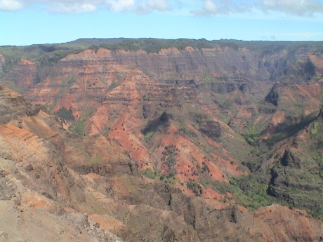 And this is what we came to see. My camera doesn't
have nearly a wide enough field of view to show the canyon in less than
about 5 shots, but this is generally what it looks like, the grand
canyon but smaller and with forests.
And this is what we came to see. My camera doesn't
have nearly a wide enough field of view to show the canyon in less than
about 5 shots, but this is generally what it looks like, the grand
canyon but smaller and with forests.
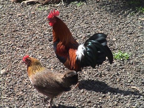 Up the road
was another lookout. In the parking for this one, we were literally
assaulted by wild chickens. Every time a car drove up, several would
surround it looking for a handout. It didn't take them long to
determine where the good pickings were. I figured that if I threw some
crushed crackers in the air, I could collect 500 of them. It turned out
that we only collected a crowd of about 30, but every scrap of a couple
of crackers was cleaned up in seconds.
Up the road
was another lookout. In the parking for this one, we were literally
assaulted by wild chickens. Every time a car drove up, several would
surround it looking for a handout. It didn't take them long to
determine where the good pickings were. I figured that if I threw some
crushed crackers in the air, I could collect 500 of them. It turned out
that we only collected a crowd of about 30, but every scrap of a couple
of crackers was cleaned up in seconds.
Chickens like are found wild all over the island. Some of them are very colorful birds. They are generally considered a pest, but nobody seems to have the desire to try to eradicate them. They eat lots of bugs and don't interfere with the natural wildlife in any serious way. They may be a problem for the seed farmers down in the flats below the canyon because in the newly planted fields, there were people sitting under umbrellas, probably there to scare away the birds so that they wouldn't decimate the seed crops. The story goes that ferrets were imported to Hawai'i to clear rats from the farm fields. When the first crate of them was delivered to Kaua'i, one of the caged ferrets bit the hand of a dock worker and he chucked the whole cage into the sea. No more were brought over so that there are no ferrets on the island. The chickens don't have to deal with ferrets raiding their nests and killing the chicks. Therefore, the chickens can reproduce without much interference.
At the end of the road is a military installation supporting the Barking Sands Navel Air Station. We drove back down the canyon, but partly on a different road, hwy 552, that leads a little further west than the road that we drove up. We then continued past the main part of the Barking Sands missile test range to the end of the road. Many of the target missiles that are the "star wars" anti-missile test targets are launched from Barking Sands.
On the way back through Lihu'e got lunch at Costco. I also hoped to find, and did find, a very good selection of Cooke Street Hawai'ian shirts. Some versions of these can be found at most Costco stores, but the really nice ones that I prefer aren't at most mainland stores. These have the print pattern sewed on the INSIDE of the shirt so that the colors are subdued and the shirts look old from the start. They had literally hundreds of them there, I got 5 more. Sandy got one too, but in a version with the print on the outside.
Walking through Costco felt just like home. I'm glad to be back in the US, even though it's still 3000 miles from home.
We also stopped at a stitchery shop in Lihu'e. Apparently, all of the shops anywhere near our home have closed and she wants to find more needlepoint canvases. There is yet another shop only a block away from our resort but it was closed when we walked by it last night. She'll check it out later.
We're flush with provisions from Costco. Since we have a full kitchen we can cook for ourselves. There are also gas grills scattered around the grounds so we have some steaks and salmon to grill as well, but tonight, its a Costco Hawai'ian pizza.
Today was a laid back day. We slept in and then Sandy and I walked up the street to another fabric shop, but they had nothing that Sandy was looking for. We walked back via the walkway along the beach.
Then it was off to Lihu'e for several items. There is a putting green here and Charlie wanted to look in the thrift stores for a putter. We found all manner of clubs, but no putters. There was also supposed to be an excellent noodle shop near the Salvation Army thrift store but we didn't find it. We stopped at WalMart for some random stuff and as we walked in, we saw the guy that had told us about the noodle shop. He tried to explain where it was again and we went back to look for it, but we STILL didn't find it. We gave up and went back to the resort for lunch, stopping at FoodLand along the way for some more provisions and some rum so that Charlie could mix up some tropical drinks. We had lunch in the resort. We didn't do much of anything in the afternoon. Dinner was a large piece of salmon (Costco), a mexican salad and some brown rice. The Mai Tai that Sandy had knocked her out, she was out of it for the rest of the evening. Tomorrow, the plan is to do the north shore excursion and maybe some snorkeling.
 Today we took the rental car up the road to the
north shore. The car is a Dodge Caliber and it's ok. It's large enough
but gutless and kind of noisy. However, it gets us around.
Today we took the rental car up the road to the
north shore. The car is a Dodge Caliber and it's ok. It's large enough
but gutless and kind of noisy. However, it gets us around.
The road to the north shore is about 30 miles long and ends in a state park and trailhead into the rain forest. There isn't much along the road until past Princeville, about 5 miles from the end of the road. Princeville is a very well developed resort community, we didn't got there. Instead, we took the narrow and twisty road past Princeville. There are lots of one lane bridges on this piece of the road. There are yield signs on BOTH ends of the bridges so that if there is a line up, the proper protocol is for only 3 or maybe 4 cars to go in one direction at a time. Violation of the protocol will likely get you a "stink eye" from a local waiting on the other side.
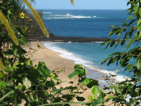 There are lots of beaches along this section, but
some of them just have poor access and little or no parking like this
one. This is a very nice piece of beach with nobody on it.
There are lots of beaches along this section, but
some of them just have poor access and little or no parking like this
one. This is a very nice piece of beach with nobody on it.
Today, our weather was outstanding. It was much cooler than the first day that we were here. The trade winds were blowing which tends to cool everything off. We are under threat of rain every day until we leave, but we've not had anything significant yet.
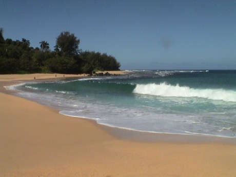 On this beach, there is a river running down to
the surf. People were swimming in the river, but not in the ocean. It
was too rough today and there were obvious rip currents. The river is
deep enough on the far side to allow diving from the rocks.
On this beach, there is a river running down to
the surf. People were swimming in the river, but not in the ocean. It
was too rough today and there were obvious rip currents. The river is
deep enough on the far side to allow diving from the rocks.
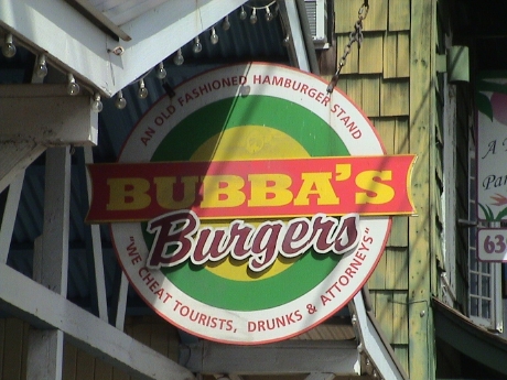 On the
way back, we stopped at Bubba's for a hamburger. Bubba's is actually
just a couple of blocks up the street from our condo. The burgers were
ok, but not great. The prices were a little high so that they may
actually "cheat" tourists.
On the
way back, we stopped at Bubba's for a hamburger. Bubba's is actually
just a couple of blocks up the street from our condo. The burgers were
ok, but not great. The prices were a little high so that they may
actually "cheat" tourists.
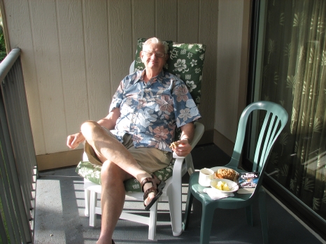 It took awhile this morning to get out,
generally laziness was the primary cause. This is Charlie having
breakfast of a Costco muffin and Costco fresh pineapple out on the
balcony, By the time that we negotiated a trip out, the Veteran's Day
Parade was running up the street outside the Pono Kai so it was clear
that we weren't going anywhere for awhile. It was about 1100 before we
got on the road.
It took awhile this morning to get out,
generally laziness was the primary cause. This is Charlie having
breakfast of a Costco muffin and Costco fresh pineapple out on the
balcony, By the time that we negotiated a trip out, the Veteran's Day
Parade was running up the street outside the Pono Kai so it was clear
that we weren't going anywhere for awhile. It was about 1100 before we
got on the road.
 The first stop was just south a mile or two at
the Coco Palms. Sandy and I celebrated our honeymoon here so many moons
ago. It has obviously fallen on hard times. Apparently, the Coco Palms
is the only resort on Kaua'i that didn't recover from hurricane Iniki
in 1992. Later, we did see a sales office at the Coconut Marketplace
for condos at the Coco Palms so somebody obviously has some plans to
renovate the place. However we also saw a notice that the property was
up for sale.
The first stop was just south a mile or two at
the Coco Palms. Sandy and I celebrated our honeymoon here so many moons
ago. It has obviously fallen on hard times. Apparently, the Coco Palms
is the only resort on Kaua'i that didn't recover from hurricane Iniki
in 1992. Later, we did see a sales office at the Coconut Marketplace
for condos at the Coco Palms so somebody obviously has some plans to
renovate the place. However we also saw a notice that the property was
up for sale.
 One of the targets for this trip was Wailua
Falls, an 80' waterfall on the Wailua River. This spot is 4 miles up a
twisty road, hwy 583, which is just outside of Lihu'e. The old
Hawai'ian kings would demonstrate their courage by diving off these
falls. 80' is a long way down. Somewhat below the falls is the Fern
Grotto, basically a cave surrounded in ferns. It is very popular for
weddings. We didn't go there this time.
One of the targets for this trip was Wailua
Falls, an 80' waterfall on the Wailua River. This spot is 4 miles up a
twisty road, hwy 583, which is just outside of Lihu'e. The old
Hawai'ian kings would demonstrate their courage by diving off these
falls. 80' is a long way down. Somewhat below the falls is the Fern
Grotto, basically a cave surrounded in ferns. It is very popular for
weddings. We didn't go there this time.
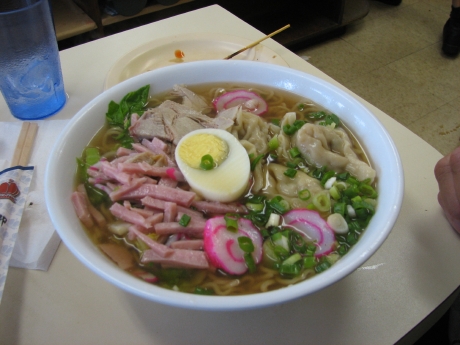 We found a description of the noodle place,
with an address this time, in one of the throwaway guide books that we
had picked up at the airport. The place is called the Hamura Inn and
they serve saimin, or shrimp soup and noodles. This is the special with
lots of extra stuff in it and boy was it good. The place is a hole in
the wall down a one way street that is next to the Salvation Army
thrift store on Rice street in Lihue. I knew it was going to be good
because it was full of locals, we were probably the only tourists in
the place. We also brought back some kind of pie from the noodle shop.
It was excellent as well.
We found a description of the noodle place,
with an address this time, in one of the throwaway guide books that we
had picked up at the airport. The place is called the Hamura Inn and
they serve saimin, or shrimp soup and noodles. This is the special with
lots of extra stuff in it and boy was it good. The place is a hole in
the wall down a one way street that is next to the Salvation Army
thrift store on Rice street in Lihue. I knew it was going to be good
because it was full of locals, we were probably the only tourists in
the place. We also brought back some kind of pie from the noodle shop.
It was excellent as well.
We stopped at the Coconut Marketplace on the way back. This is basically an open air mall targeting tourists and most of the prices were at tourist level, in other words, very high.
About an hour before sundown, we took a walk along the beach walkway and road south about half a mile. There was an old wooden house for sale right across the one lane road from the shore. The seller wanted $1.5M for it. Down the street, there was a much larger and much newer house for sale for $999K. It was just a block back from the shore. I guess that location does count. We looped back to the condo via the main road walking by hedges along the way. There were chickens everywhere, including up inside the hedges. We flushed a bunch out that were roosting several feet off the ground. I didn't know that chickens climbed up in bushes. There is also a hen with 8 chicks that runs around the condo grounds below our balcony. I was tossing cracker crumbs over the edge and the hen was actively chasing away other chickens so that her chicks could get first crack at the crumbs. These chicks were pretty big, about the same size as the doves that are all over here as well. I assume that as soon as she lays another clutch of eggs, this batch of chicks will get chased out as well.
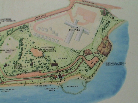 This morning we went to Lydgate County
Park which is about 3 miles south of the Pono Kai. This is a public
beach with a lagoon that has been created from large rocks. In our
travels around the island, every beach we came to had red flags out
indicating dangerous conditions such as rip currents. Further, when I
asked people that had been snorkeling at those beaches about the
conditions, the uniform reply was "murky." There is so much chop that
the bottom is getting churned up. Snorkeling is best done in shallow
and calm water where the visibility has a chance of being good.
This morning we went to Lydgate County
Park which is about 3 miles south of the Pono Kai. This is a public
beach with a lagoon that has been created from large rocks. In our
travels around the island, every beach we came to had red flags out
indicating dangerous conditions such as rip currents. Further, when I
asked people that had been snorkeling at those beaches about the
conditions, the uniform reply was "murky." There is so much chop that
the bottom is getting churned up. Snorkeling is best done in shallow
and calm water where the visibility has a chance of being good.
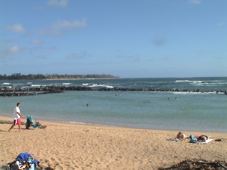 The lagoon itself is a man made
structure intended to produce good swimming conditions even when the
surf makes unprotected swimming unwise.
The lagoon itself is a man made
structure intended to produce good swimming conditions even when the
surf makes unprotected swimming unwise.
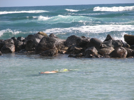 This may be a place for lightweight
snorkeling, but you can see why I choose to do it here. That's me in
the photo. There is still some surge in the lagoon when the surf breaks
over the rocks but it is much worse outside the breakwater. Trying to
swim out there would just get one very well acquainted with the rocks.
The visibility was about 15' but the water was no more than 4' deep so
it was fine. There were lots of fish in the lagoon, maybe thousands,
but no coral. This was a safe swim, especially because there was a
manned lifeguard tower right there.
This may be a place for lightweight
snorkeling, but you can see why I choose to do it here. That's me in
the photo. There is still some surge in the lagoon when the surf breaks
over the rocks but it is much worse outside the breakwater. Trying to
swim out there would just get one very well acquainted with the rocks.
The visibility was about 15' but the water was no more than 4' deep so
it was fine. There were lots of fish in the lagoon, maybe thousands,
but no coral. This was a safe swim, especially because there was a
manned lifeguard tower right there.
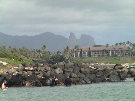 Looking north from the lagoon, Charlie commented on
this ridge line. I said, "yeah, that's Madonna sleeping." I don't know
if it is known that way here, but it is a good description.
Looking north from the lagoon, Charlie commented on
this ridge line. I said, "yeah, that's Madonna sleeping." I don't know
if it is known that way here, but it is a good description.
 There were chickens all over the beach here too.
This hen had 4 chicks in tow. They were probably less than a week old.
There was a hose coiled up near this drinking fountain and I saw the
hen carefully checking out both ends to see if there was water standing
in the hose. I figure that she was thirsty so I hit the button on the
fountain and it overshot like many of them do. This spilled water on
the concrete base and it took the hen and chicks about 2 seconds to
dive in. The hen will also pick a spot on the ground and just tear it
up with her talons, then she will step back and let the chicks dive in
to pick out whatever bugs are turned up.
There were chickens all over the beach here too.
This hen had 4 chicks in tow. They were probably less than a week old.
There was a hose coiled up near this drinking fountain and I saw the
hen carefully checking out both ends to see if there was water standing
in the hose. I figure that she was thirsty so I hit the button on the
fountain and it overshot like many of them do. This spilled water on
the concrete base and it took the hen and chicks about 2 seconds to
dive in. The hen will also pick a spot on the ground and just tear it
up with her talons, then she will step back and let the chicks dive in
to pick out whatever bugs are turned up.
We had lunch at a local mexican grab joint, the Burrito Head. It is about 2 blocks south of the condos. The burrito was excellent but it was also quite large and it nailed me for much of the afternoon. I even took a nap which I hardly ever do.
Our internet connection is working out ok, it's fairly slow at 1 Mbps but it's a lot faster than we have been used to. There was only one internet shop in Wellington that had peak rates almost that fast, the rest of the "broadband" connections topped out at about 300 kbps or slower. However, the Roadrunner cable connection in this condo senses IP addresses and it allows only one computer to connect. This is bogus so I set the iBook up to share it's ethernet connection via WiFi so that Sandy's computer could connect as well. I think that this took 4 clicks to set up. As far as Roadrunner was concerned it saw only one computer connected.
The trade winds are keeping us cool. As I type this, I am sitting out on the balcony watching the breeze blow through the coconut palms. This is pretty tough duty.
 There are
lots of little birds that look kind of like doves that come onto the
balcony. They have no fear of people and will walk right up to our
feet. There are crumbs and sand on the balcony, but these little
buggers can pick out a crumb from the background of sand, seemingly
without error. They also prefer the smaller pieces and will pick out
the tiny crumbs before they attack the larger pieces which they seem to
have difficulty with. When they pick up a larger piece, they will bash
it against the floor trying to break it up. If they fail, they will
discard the piece.
There are
lots of little birds that look kind of like doves that come onto the
balcony. They have no fear of people and will walk right up to our
feet. There are crumbs and sand on the balcony, but these little
buggers can pick out a crumb from the background of sand, seemingly
without error. They also prefer the smaller pieces and will pick out
the tiny crumbs before they attack the larger pieces which they seem to
have difficulty with. When they pick up a larger piece, they will bash
it against the floor trying to break it up. If they fail, they will
discard the piece.
After today, we've got 2 full days here until Wednesday Nov 14. We take Charlie to the airport early in the morning. He connects through Honolulu to Oakland but he has a really long layover in Honolulu. Our flight directly to Oakland doesn't leave until 2300. We'll get to Oakland only a couple of hours after he does. Then we connect to LAX. We'll be there Thursday morning sometime.
 Today,
we went back to Lydgate County Park for a picnic lunch and another
swim. This time I remembered to bring my cheap underwater camera. I had
used it in Western Samoa where it leaked. After cleaning the
"watertight" case and seal, I had tested it in the sink on the ms
Statendam where it didn't leak. I assumed that all the bashing against
the rocks and coral that it had received in Samoa had tweaked the case
allowing small leaks. I used it again in the lagoon where it did not
leak and I finished shooting up a roll of film. Remember those? After
rewinding the film and opening the camera, it was very clean inside
indicating that not much or any water actually got in the camera. Maybe
some of the pictures will come out.
Today,
we went back to Lydgate County Park for a picnic lunch and another
swim. This time I remembered to bring my cheap underwater camera. I had
used it in Western Samoa where it leaked. After cleaning the
"watertight" case and seal, I had tested it in the sink on the ms
Statendam where it didn't leak. I assumed that all the bashing against
the rocks and coral that it had received in Samoa had tweaked the case
allowing small leaks. I used it again in the lagoon where it did not
leak and I finished shooting up a roll of film. Remember those? After
rewinding the film and opening the camera, it was very clean inside
indicating that not much or any water actually got in the camera. Maybe
some of the pictures will come out.
I finally figured out why Sandy was so interested in the state of that $10 camera. She is lusting after a new Olympus digital camera model that is watertight to 3 meters. She was ready to buy one in the airport in Sydney until she check the US prices and found them to be a lot lower than she could get in a duty free store. I expect one of those to show up at home sometime after we get there.
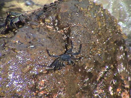 After
swimming for about an hour, we had lunch and I took a walk around. On
the ocean side of the breakwater, the rocks were literally covered in
this little crabs which would sit there above the water line for
extended periods. The swells would break against the breakwater and
much of the surge would wash through the rocks into the lagoon causing
a the surge inside. Also, it is clear that the rock wall is porous
enough such that most of the fish can probably swim in and out of the
lagoon as they wish. The surge would also bring in fresh ocean water
with food for the fish already in the lagoon.
After
swimming for about an hour, we had lunch and I took a walk around. On
the ocean side of the breakwater, the rocks were literally covered in
this little crabs which would sit there above the water line for
extended periods. The swells would break against the breakwater and
much of the surge would wash through the rocks into the lagoon causing
a the surge inside. Also, it is clear that the rock wall is porous
enough such that most of the fish can probably swim in and out of the
lagoon as they wish. The surge would also bring in fresh ocean water
with food for the fish already in the lagoon.
Lydgate Park is adjacent to Wailua River State Part at the beach. Today was a Monday but there were far more people in the parks than yesterday, which was a Sunday AND a holiday, go figure. In any event, we found the last table with any shade in the state park portion. I walked over to the river and found some more Hawai'ian ruins. The river mouth chokes into a fast moving channel about 20' wide and 3 or 4 feet deep before it dumps into the ocean. A bunch of little kids were playing in the river with nary an adult around watching them. They would just right into the current and let it carry them to the ocean where it became very shallow and they'd then get up, run back up the beach and do it again.
After I fell asleep laying on a picnic table bench with a towel as a pillow, Sandy gently reminded me that it was time to go back to the condo, so here we are.
Today is a laid back day, we'd checked off the things that we wanted to do or see so we are just resting in preparation for our trip home. It's a red eye that leaves tomorrow night.
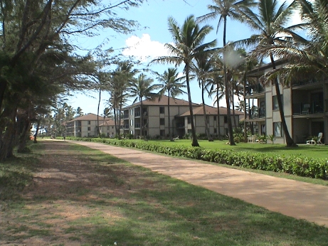 We took
about a half mile walk north along the shoreline just before lunch.
This is the Pono Kai as seen from the walkway. The beach is immediately
to the left of the photo.
We took
about a half mile walk north along the shoreline just before lunch.
This is the Pono Kai as seen from the walkway. The beach is immediately
to the left of the photo.
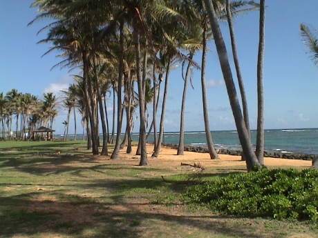 This area is called the coconut coast for good
reason. There are coconut palms everywhere. We stopped about here to
rest on the grass in the shade of the palms. Before we got back to our
condo, we stopped to feed the koi in the fishpond of the complex. The
trade winds were blowing lightly keeping everything cool. It is a
pretty nice day for our last full day here.
This area is called the coconut coast for good
reason. There are coconut palms everywhere. We stopped about here to
rest on the grass in the shade of the palms. Before we got back to our
condo, we stopped to feed the koi in the fishpond of the complex. The
trade winds were blowing lightly keeping everything cool. It is a
pretty nice day for our last full day here.
We'll check out at 1000 tomorrow after leaving Charlie at the airport at about 0700. Then we have 11 hours before we have to return to the airport to drop off the rental car and check in for our flight.
Our internet connect turns into a pumpkin sometime later today so our next update may be the wrap up post from home.
We're packing up in preparation of a 1000 checkout time. Charlie has been delivered to the airport already and we're almost ready to go. The internet is still working so it will probably expire after we are gone. We have all day to kick around with little to do specifically except run by WalMart for some TSA locks. The place has been cleaned up, the furniture arranged back to where we found it. Most of the dishes are done except for a final small load that we'll set going just before we leave. I'm all packed, Sandy is still working on her stuff but she has over an hour to finish and she's nearly done now.
The trade winds were supposed to be back this morning but it is dead still outside, warm and humid, similar to when we got here.
We found our locks and then went to the Kaua'i Museum in downtown Lihu'e for a little history of the island. As I suspected, some of the one lane bridges that had a distinctive railroad look to them were probably cane road bridges. At one time, there was an extensive narrow gauge network of cane railroads around the islands to serve the sugar cane fields and mills. Almost all of this is now gone, but the bridges remain. The museum also had one of the original rain gauges that was used on top of the mountain which gets 400+ inches of rain a year.
The succession of the Kaua'i kings was too difficult to follow without really detailed study. Kaua'i was the only island that wasn't successfully invaded by any other island. Kaua'i eventually came under the dominion of Kamehameha through negotiation and then became a US territory along with the rest of the islands, again through negotiation although some Hawai'ians still consider the annexation an illegal act.
Then we sat in the car under a shade tree in front of the county building and ate lunch which we had made from the residual food that we had accumulated over the week. I had cut the bottom of my foot sometime the day before yesterday and it was bothering me so we elected to go to Borders and sit it out. Starbucks was next door so that is where we settled down to wait for a few hours but the severe A/C eventually drove us out. That was the first time I had ever been in a Starbucks, the place reeks of coffee. We found a spot where we could park the car in the shade and waited there for an hour or so until it got dark. Then it was over to Costco to get something to eat and some gas for the car. Then it was off to the airport. We got there a half hour before the check in counter opened and it took about an hour to get checked in and through security. Then we found an open WiFi hot spot in the terminal which is why you are seeing this now.
After the red eye in from Lihu'e, we're back. We got in about 0930. I got almost no sleep but the flights were otherwise uneventful. Charlie was in school when we arrived so we caught a cab back from LAX. I've spent the morning partially unpacking but mostly finding and backing up all the photos and video that we've taken on the trip. I had streamed 4 video tapes to the iPod but I filled it up. Apparently, it got too full and I couldn't actually read any of the files back so I have to re-stream them from tape which will take about 4 hours but is otherwise no big deal. After I get everything backed up, then I'll upgrade the iMac to Mac OS 10.5 which arrived while we were gone.
Sometime later today, I'll probably hit a brick wall from lack of sleep and crash just as Sandy has already.
I believe that I gained about 3 lbs during the trip, not too bad considering how much I ate.
 We inspected the
cabin today, it survived with little damage although all the houses in
an arc about half way around are gone. This was a very large house
adjacent to my property. We have 6 window panes upstairs that cracked
due to the heat. A plastic sewer clean out pipe that sticks out of the
ground by about a foot is partially melted. A plastic no parking sign
posted on the front of the house is all curled up from the heat. The
houses that didn't make it are just fireplaces, foundations and ash
with a little metal debris mixed in.
We inspected the
cabin today, it survived with little damage although all the houses in
an arc about half way around are gone. This was a very large house
adjacent to my property. We have 6 window panes upstairs that cracked
due to the heat. A plastic sewer clean out pipe that sticks out of the
ground by about a foot is partially melted. A plastic no parking sign
posted on the front of the house is all curled up from the heat. The
houses that didn't make it are just fireplaces, foundations and ash
with a little metal debris mixed in.
This page has been accessed times since July 20, 2007
© 2007-2008 George Schreyer
Created July 20, 2007
Last Updated January 29, 2008